Approximate Location Map
Large Map »
Latitude: 55.3067 / 55°18'24"N
Longitude: -1.9655 / 1°57'55"W
OS Eastings: 402289
OS Northings: 601405
OS Grid: NU022014
Mapcode National: GBR G7Q2.8H
Mapcode Global: WHB0P.SW75
Plus Code: 9C7W824M+MR
Entry Name: Pant Circa 15 Yards North East of Allerdene
Listing Date: 29 May 1987
Grade: II
Source: Historic England
Source ID: 1303353
English Heritage Legacy ID: 236321
ID on this website: 101303353
Location: Great Tosson, Northumberland, NE65
County: Northumberland
Civil Parish: Whitton and Tosson
Traditional County: Northumberland
Lieutenancy Area (Ceremonial County): Northumberland
Church of England Parish: Upper Coquetdale
Church of England Diocese: Newcastle
Tagged with: Architectural structure
NU 00 SW
3/82
TOSSON
ALLERDENE
Pant c.15 yards
north-east of
Allerdene
II
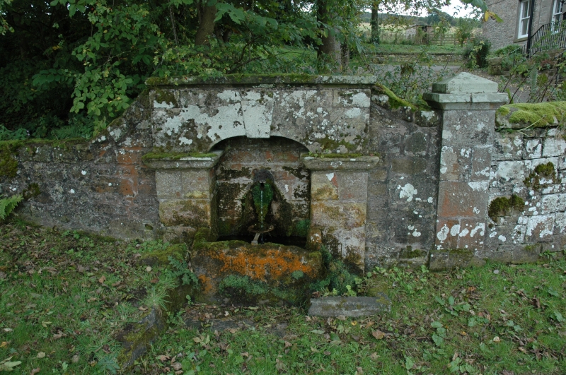
Pant. Late C18 or early C19. Dressed stone. Elliptical-arched recess with
keystone and moulded imposts. Lion's head spout and stone trough.
Listing NGR: NU0228901405
External links are from the relevant listing authority and, where applicable, Wikidata. Wikidata IDs may be related buildings as well as this specific building. If you want to add or update a link, you will need to do so by editing the Wikidata entry.


Other nearby listed buildings
