Latitude: 51.6174 / 51°37'2"N
Longitude: -2.2557 / 2°15'20"W
OS Eastings: 382389
OS Northings: 190982
OS Grid: ST823909
Mapcode National: GBR 1P2.DKC
Mapcode Global: VH95H.VLBZ
Plus Code: 9C3VJP8V+XP
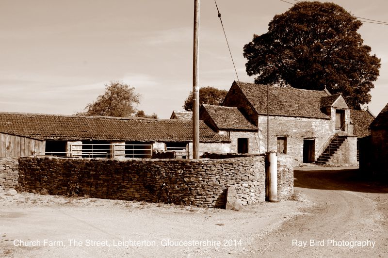
Entry Name: Outbuilding with Loft to North of Barns at Church Farm
Listing Date: 1 May 1986
Grade: II
Source: Historic England
Source ID: 1303548
English Heritage Legacy ID: 129615
ID on this website: 101303548
Location: Leighterton, Cotswold, Gloucestershire, GL8
County: Gloucestershire
District: Cotswold
Civil Parish: Boxwell with Leighterton
Traditional County: Gloucestershire
Lieutenancy Area (Ceremonial County): Gloucestershire
Church of England Parish: BoxwellSt Mary the Virgin and Leighterton St Andrew
Church of England Diocese: Gloucester
Tagged with: Appendage
BOXWELL WITH THE STREET (Leighterton Village ST 8290 east side) LEIGHTERTON 2/24 Outbuilding with loft to north of barns at Church Farm
GV II
Stable with loft and attached cow house. C18. Random rubble limestone; dressed quoins to central block; stone slate roof. Stable with loft over; single-storey additions at each end. Front: central doorway to stable with timber lintel and plank door; small-paned casement to left, stone stairs to right with projecting nosing to landing; gabled loft doorway. Single-storey addition to right with cow doorway and opening to right, both with stone lintels. Parapet gabled east end to central block and addition, both with ball finials. Single-storey addition at left has plank door with stone lintel. C20 addition in concrete block to east not of special interest. Included for Group Value.
Listing NGR: ST8238990982
External links are from the relevant listing authority and, where applicable, Wikidata. Wikidata IDs may be related buildings as well as this specific building. If you want to add or update a link, you will need to do so by editing the Wikidata entry.


Other nearby listed buildings