Latitude: 51.4535 / 51°27'12"N
Longitude: -0.989 / 0°59'20"W
OS Eastings: 470346
OS Northings: 173210
OS Grid: SU703732
Mapcode National: GBR QGG.ZD
Mapcode Global: VHDWS.TQ0L
Plus Code: 9C3XF236+CC
Entry Name: The Rose and Thistle Public House
Listing Date: 14 December 1978
Grade: II
Source: Historic England
Source ID: 1303783
English Heritage Legacy ID: 38743
ID on this website: 101303783
Location: Coley, Reading, Berkshire, RG1
County: Reading
Electoral Ward/Division: Battle
Parish: Non Civil Parish
Built-Up Area: Reading
Traditional County: Berkshire
Lieutenancy Area (Ceremonial County): Berkshire
Church of England Parish: Reading Holy Trinity
Church of England Diocese: Oxford
Tagged with: Pub
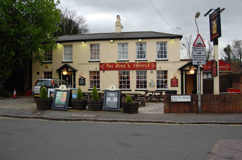
ARGYLE ROAD
1.
5128
The Rose and Thistle
Public House
SU 7073 12/8
II
2.
Circa 1840 modernised. 2 storeys, 6 bays, glazing bar sashes. Slate roof.
2 modern pedimented doorpieces.
Listing NGR: SU7034673210
External links are from the relevant listing authority and, where applicable, Wikidata. Wikidata IDs may be related buildings as well as this specific building. If you want to add or update a link, you will need to do so by editing the Wikidata entry.


Other nearby listed buildings