Latitude: 51.6812 / 51°40'52"N
Longitude: -2.1754 / 2°10'31"W
OS Eastings: 387968
OS Northings: 198061
OS Grid: ST879980
Mapcode National: GBR 1ND.GV4
Mapcode Global: VH95C.70TJ
Plus Code: 9C3VMRJF+FR
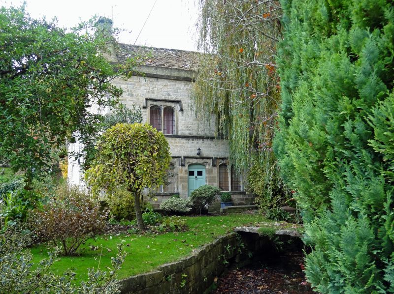
Entry Name: Mullions, Adjacent to Churchyard of Church of Holy Cross on West Side, and Garden Wall
Listing Date: 21 March 1985
Grade: II
Source: Historic England
Source ID: 1305261
English Heritage Legacy ID: 128293
ID on this website: 101305261
Location: Avening, Cotswold, Gloucestershire, GL8
County: Gloucestershire
District: Cotswold
Civil Parish: Avening
Built-Up Area: Avening
Traditional County: Gloucestershire
Lieutenancy Area (Ceremonial County): Gloucestershire
Church of England Parish: Avening Holy Cross
Church of England Diocese: Gloucester
Tagged with: Architectural structure
ST 89 NE AVENING AVENING VILLAGE
3/17 Mullions, adjacent to churchyard of Church of the Holy Cross on west side, and garden wall.
II
Detached house. Early C19. Coursed and dressed limestone with large long and short quoins, Cotswold stone slate roof with front parapet, wide coped gables with stone stack to each end. Main range with later rear outshut and small single storey building attached on right. 2 storeys and attic. 2 windows - twin segmental-head leaded casements under square hood mould with sill band below. Ground floor has similar windows flanking central segmental-headed 6-panel door, forming continuous series of square hood moulds. Small leaded attic window in left gable with pointed arch and hood mould. Curved garden wall in limestone, with 2 courses of very large blocks and 1 coping course, adjoining carved pier by gate at north east corner of house, about 30m in length and forming part of a bridge over a stream from about halfway along, at a large vertical pier made from a single stone block, to the end.
Listing NGR: ST8796798058
External links are from the relevant listing authority and, where applicable, Wikidata. Wikidata IDs may be related buildings as well as this specific building. If you want to add or update a link, you will need to do so by editing the Wikidata entry.


Other nearby listed buildings