Latitude: 52.4895 / 52°29'22"N
Longitude: 1.1136 / 1°6'48"E
OS Eastings: 611486
OS Northings: 292512
OS Grid: TM114925
Mapcode National: GBR TGF.SFM
Mapcode Global: VHL8N.8P2D
Plus Code: 9F43F4Q7+RC
Entry Name: Church of All Saints
Listing Date: 7 December 1959
Grade: I
Source: Historic England
Source ID: 1305560
English Heritage Legacy ID: 225168
Also known as: All Saints, Carleton Rode
ID on this website: 101305560
Location: All Saints Church, Carleton Rode, South Norfolk, NR16
County: Norfolk
District: South Norfolk
Civil Parish: Carleton Rode
Traditional County: Norfolk
Lieutenancy Area (Ceremonial County): Norfolk
Church of England Parish: Carleton Rode All Saints
Church of England Diocese: Norwich
Tagged with: Church building
1. 5321 CARLETON RODE CHURCH ROAD Church of All Saints TM 19 SW 7/1 7.12.59
I GV
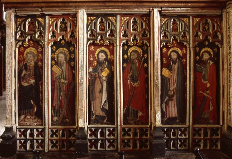
2. Fabric from late C13. Late C13 chancel with 2 windows with 2 trefoil headed lights and trefoil over, 4-light east window with intersecting tracery, the mullions with thin shafts. Late C13 south doorway with moulded arch and shafts and double piscina with trefoiled arches and quatrefoil above with hood-mould with leaf corbels. Nave, and north and south aisles with clerestory, with mainly Perpendicular windows, but late C13 south aisle east window and north aisle west window and north door. Four bay north and south arcades and chancel arch with octagonal piers and double-hollow-chamfered arches. C15 south porch with diagonal buttresses, rounded arch and blocked Perpendicular windows. Squat C14 west tower repaired in 1717 with angle buttresses, embattled parapet and pinnacles. Interior: C15 screen with painted figures. C13 stained glass panel in south window of chancel. Octagonal font. Late C16 alter table. Built of flint rubble with stone dressings, chancel rendered, and with tiled, slate and lead roofs.
Listing NGR: TM1148692512
External links are from the relevant listing authority and, where applicable, Wikidata. Wikidata IDs may be related buildings as well as this specific building. If you want to add or update a link, you will need to do so by editing the Wikidata entry.


Other nearby listed buildings