Latitude: 51.5814 / 51°34'52"N
Longitude: 0.6988 / 0°41'55"E
OS Eastings: 587083
OS Northings: 190395
OS Grid: TQ870903
Mapcode National: GBR QNX.X1G
Mapcode Global: VHKHF.2J82
Plus Code: 9F32HMJX+GG
Entry Name: Wall Enclosing a Garden to the North, West and South of Rochford Hall with a Spur Wall Running from the Northern Boundary Towards the Ruin of the North Western Angle Turret with Barns Attached to Nort
Listing Date: 27 July 1959
Grade: II
Source: Historic England
Source ID: 1307122
English Heritage Legacy ID: 123201
ID on this website: 101307122
Location: Rochford Hundred Golf Club, Rochford, Essex, SS4
County: Essex
District: Rochford
Civil Parish: Rochford
Built-Up Area: Rochford
Traditional County: Essex
Lieutenancy Area (Ceremonial County): Essex
Church of England Parish: Rochford St Andrew
Church of England Diocese: Chelmsford
Tagged with: Wall
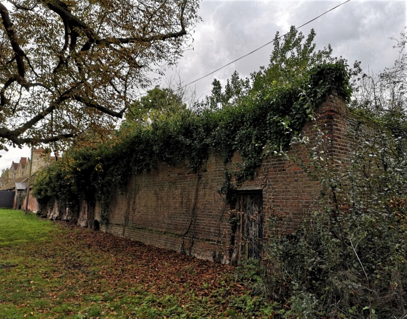
ROCHFORD HALL ROAD TQ 86/8790 14/210 Rochford Hall. Wall enclosing a garden to the north, west and 27.7.59 south of Rochford Hall with a spur wall running from the northern boundary towards the ruin of the north western angle turret with barns attached to north east boundary GV II Wall and attached barns to north east boundary. C16 with later repairs. Red brick with some black diapering. English bond. The south east face runs north parallel to Rochford Hall Drive, where it is approx. 2-3 metres high. 2 later barns are attached to this length of wall, they face the garden. They are timber framed to front and returns, the wall acting as rear walls. The southern barn has a red tiled and corrugated asbestos clad roof, there is an aisle to the west face, straight braces to top plate and some hanging knees to tie beams, it is boarded internally. The northern barn is weatherboarded with a red plain tiled roof. Near the north eastern angle is a small gateway. The northern wall, running parallel with Hall Road is the tallest section, 3 metres or more and although covered by climbers and shrubs much black diapering shows. Off centre east of the northern face is a southern spur wall which may have been attached to the now ruined north west turret of the Hall. The south western face is 2-3 metres tall. The south west angle is south of the Hall and the southern face has 2 sections which angle further south and terminates to the south of the Hall. There are carriageways through the wall to north and south. The whole enclosed area is said to be approx. 8 acres. RCHM 2.
Listing NGR: TQ8708390395
External links are from the relevant listing authority and, where applicable, Wikidata. Wikidata IDs may be related buildings as well as this specific building. If you want to add or update a link, you will need to do so by editing the Wikidata entry.


Other nearby listed buildings