Approximate Location Map
Large Map »
Latitude: 52.7747 / 52°46'28"N
Longitude: -2.3807 / 2°22'50"W
OS Eastings: 374416
OS Northings: 319744
OS Grid: SJ744197
Mapcode National: GBR 7Z.YB81
Mapcode Global: WH9CR.DJL6
Plus Code: 9C4VQJF9+VP
Entry Name: 10, Chetwynd Road
Listing Date: 29 June 1978
Grade: II
Source: Historic England
Source ID: 1307286
English Heritage Legacy ID: 255356
ID on this website: 101307286
Location: Newport, Telford and Wrekin, Shropshire, TF10
County: Telford and Wrekin
Civil Parish: Newport
Built-Up Area: Newport
Traditional County: Shropshire
Lieutenancy Area (Ceremonial County): Shropshire
Church of England Parish: Chetwynd St Michael and All Angels
Church of England Diocese: Lichfield
Tagged with: Building
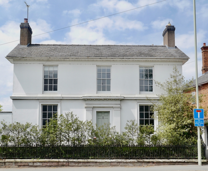
CHETWYND ROAD
1.
5362
(East Side)
No 10
SJ 7419 3/72
II
2.
Early C19. Engraved stucco; 2 storeys; 3 sash windows, the lowers in moulded
architraves; sill band at 1st floor; plain doorway with heavy cornice hood
on consoles; plain frieze and eaves; slates.
Listing NGR: SJ7441619744
External links are from the relevant listing authority and, where applicable, Wikidata. Wikidata IDs may be related buildings as well as this specific building. If you want to add or update a link, you will need to do so by editing the Wikidata entry.


Other nearby listed buildings
