Latitude: 52.7935 / 52°47'36"N
Longitude: -2.8993 / 2°53'57"W
OS Eastings: 339453
OS Northings: 322154
OS Grid: SJ394221
Mapcode National: GBR 79.X46Y
Mapcode Global: WH8BC.F1LQ
Plus Code: 9C4VQ4V2+C7
Entry Name: Castle, Remains of
Listing Date: 19 January 1952
Last Amended: 21 October 1987
Grade: II
Source: Historic England
Source ID: 1307325
English Heritage Legacy ID: 256694
ID on this website: 101307325
Location: St John the Baptist's Church, Ruyton-XI-Towns, Shropshire, SY4
County: Shropshire
Civil Parish: Ruyton-XI-Towns
Built-Up Area: Ruyton-XI-Towns
Traditional County: Shropshire
Lieutenancy Area (Ceremonial County): Shropshire
Church of England Parish: Ruyton-in-the-XI Towns St John the Baptist
Church of England Diocese: Lichfield
RUYTON-XI-TOWNS C.P. CHURCH STREET (north
SJ 32 SE side)
8/142 Castle , remains of
- [formerly listed as The
Castle (remains) (in
19.1.52 Church yard)]
GV II
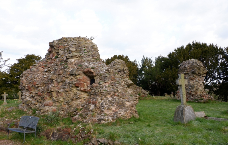
Castle, remains of. Early C14 for Edmund, Earl of Arundel on site of
castle destroyed c.1212. Sandstone rubble masonry with facing removed.
Fragmentary remains of 3 walls of small square keep on slightly raised
platform; footings of another wall projecting at right-angles to north
from north-west corner. Walls stand to a maximum of 10m high and north
and south sections have rectangular inward-sloping openings of indeterminate
date. Scheduled Ancient Monument, County No. 71. B.o.E. p. 238; D.H.S.
Cranage, The Churches of Shropshire, Part 9 (1908), pp. 823, 824-5.
Listing NGR: SJ3945322154


Other nearby listed buildings