Approximate Location Map
Large Map »
Latitude: 51.1286 / 51°7'42"N
Longitude: -2.7419 / 2°44'31"W
OS Eastings: 348176
OS Northings: 136848
OS Grid: ST481368
Mapcode National: GBR MJ.935D
Mapcode Global: VH8B3.FW9Q
Plus Code: 9C3V47H5+C6
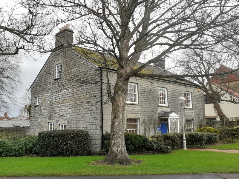
Entry Name: Street Farmhouse
Listing Date: 13 January 1986
Grade: II
Source: Historic England
Source ID: 1308044
English Heritage Legacy ID: 267777
ID on this website: 101308044
Location: Street, Somerset, BA16
County: Somerset
District: Mendip
Civil Parish: Street
Built-Up Area: Street
Traditional County: Somerset
Lieutenancy Area (Ceremonial County): Somerset
Tagged with: Farmhouse
STREET CP FARM ROAD (East side)
ST43NE
10/66 Street Farmhouse
-
- II
Farmhouse, now store. Post 1827, ante 1843. Coursed and squared rubble, slate roof, end rubble stacks. Symmetrical
frontage of 2 storeys and 3 bays, 16-pane sash windows, wedge lintols. Central door opening, 6-panelled door,
tramsomlight; pedimented "trellis" porch with lead roof on wooden posts. (McGarvie M., Guide to Historic Street,
Unpublished).
Listing NGR: ST4817636848
External links are from the relevant listing authority and, where applicable, Wikidata. Wikidata IDs may be related buildings as well as this specific building. If you want to add or update a link, you will need to do so by editing the Wikidata entry.


Other nearby listed buildings
