Latitude: 53.8846 / 53°53'4"N
Longitude: -2.5752 / 2°34'30"W
OS Eastings: 362288
OS Northings: 443305
OS Grid: SD622433
Mapcode National: GBR BRGJ.87
Mapcode Global: WH967.DMYD
Plus Code: 9C5VVCMF+RW
Entry Name: 12 and 14, Talbot Street
Listing Date: 13 February 1967
Grade: II
Source: Historic England
Source ID: 1308595
English Heritage Legacy ID: 182963
ID on this website: 101308595
Location: Chipping, Ribble Valley, Lancashire, PR3
County: Lancashire
District: Ribble Valley
Civil Parish: Chipping
Built-Up Area: Chipping
Traditional County: Lancashire
Lieutenancy Area (Ceremonial County): Lancashire
Church of England Parish: Chipping St Bartholomew
Church of England Diocese: Blackburn
Tagged with: House
SD 64 SW CHIPPING TALBOT STREET
4/76 Nos. 12 and 14 13.2.67
GV II
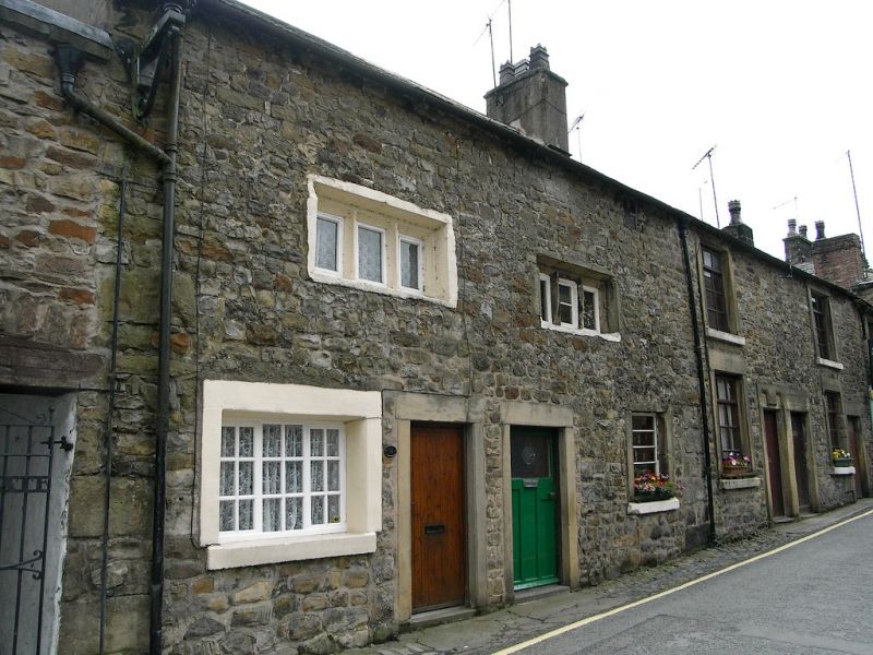
2 cottages, probably formerly one house, late C17th, altered. Rubble with roof of slate and stone slate. 2 storeys with attic. No. 14 (to the left) has a window with cement reveals on the ground floor, with a 3-light mullioned window with outer chamfer and inner hollow chamfer on the 1st floor. Door with crude plain stone surround to the right, chimney at the left. No. 12 has a window with plain stone surround, with a 3-light mullioned window with outer chamfer and inner hollow chamfer on the 1st floor. Above is a small attic window with plain reveals. Door, to the left, has crude plain stone surround. Chimney at the right-hand end. A change in stonework suggests that the eaves of both houses have been raised.
Listing NGR: SD6228843305
External links are from the relevant listing authority and, where applicable, Wikidata. Wikidata IDs may be related buildings as well as this specific building. If you want to add or update a link, you will need to do so by editing the Wikidata entry.


Other nearby listed buildings