Latitude: 51.4903 / 51°29'24"N
Longitude: -0.6474 / 0°38'50"W
OS Eastings: 494002
OS Northings: 177681
OS Grid: SU940776
Mapcode National: GBR F8B.K3Z
Mapcode Global: VHFT7.QSLX
Plus Code: 9C3XF9R3+42
Entry Name: Chapel of St Mary Magdalene, Boveney
Listing Date: 23 September 1955
Grade: I
Source: Historic England
Source ID: 1309414
English Heritage Legacy ID: 44029
ID on this website: 101309414
Location: St Mary's Church, Boveney, Buckinghamshire, SL4
County: Buckinghamshire
Civil Parish: Dorney
Traditional County: Buckinghamshire
Lieutenancy Area (Ceremonial County): Buckinghamshire
Church of England Parish: Eton
Church of England Diocese: Oxford
Tagged with: Church building
SU 97 NW DORNEY LOCK PATH
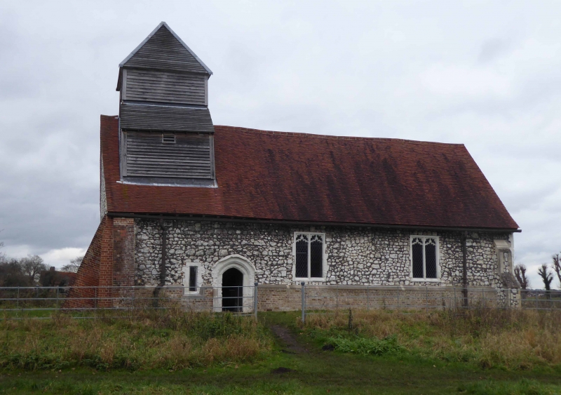
10/418 Chapel of St Mary
Magdalene, Boveney
23.9.55
- 1
C12. Chalk and flint coursed rubble with ashlar dressings. C15 windows;
weather-boarded tower. RCHM I, p.60.
Listing NGR: SU9400377681
External links are from the relevant listing authority and, where applicable, Wikidata. Wikidata IDs may be related buildings as well as this specific building. If you want to add or update a link, you will need to do so by editing the Wikidata entry.


Other nearby listed buildings