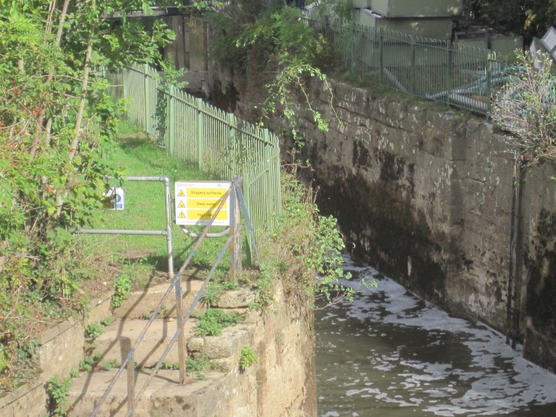
Latitude: 53.9921 / 53°59'31"N
Longitude: -0.9159 / 0°54'57"W
OS Eastings: 471173
OS Northings: 455658
OS Grid: SE711556
Mapcode National: GBR QQ18.HP
Mapcode Global: WHFBZ.XX1H
Plus Code: 9C5XX3RM+RJ
Entry Name: Stamford Bridge Lock, Derwent Navigation
Listing Date: 14 April 1987
Grade: II
Source: Historic England
Source ID: 1309871
English Heritage Legacy ID: 167741
ID on this website: 101309871
Location: Stamford Bridge, East Riding of Yorkshire, YO41
County: East Riding of Yorkshire
Civil Parish: Stamford Bridge
Built-Up Area: Stamford Bridge
Traditional County: Yorkshire
Lieutenancy Area (Ceremonial County): East Riding of Yorkshire
Church of England Parish: Stamford Bridge St John the Baptist
Church of England Diocese: York
Tagged with: Lock Architectural structure
STAMFORD BRIDGE DERWENT NAVIGATION 7155 7/52 Stamford Bridge Lock GV II
River lock. c1720, probably to a design of c1704. By George Sorocold for the Commissioners of the Derwent Navigation. Ashlar with some coursed rubble. Short upstream cut to large serpentine basin which narrows abruptly to the downstream gate which is followed by a long serpentine cut with stepped sides and passing places for boats. This cut passes under the north span of the Derwent Road Bridge (qv) before emptying into the Derwent.
Listing NGR: SE7117355658
External links are from the relevant listing authority and, where applicable, Wikidata. Wikidata IDs may be related buildings as well as this specific building. If you want to add or update a link, you will need to do so by editing the Wikidata entry.


Other nearby listed buildings