Latitude: 50.2104 / 50°12'37"N
Longitude: -5.2041 / 5°12'14"W
OS Eastings: 171482
OS Northings: 39401
OS Grid: SW714394
Mapcode National: GBR Z4.RXRP
Mapcode Global: VH12K.RZ42
Plus Code: 9C2P6Q6W+58
Entry Name: Chapel Hill Farmhouse
Listing Date: 12 September 1989
Grade: II
Source: Historic England
Source ID: 1310144
English Heritage Legacy ID: 66772
ID on this website: 101310144
LANNER CHAPEL HILL
SW 73 NW
(east side)
9/216
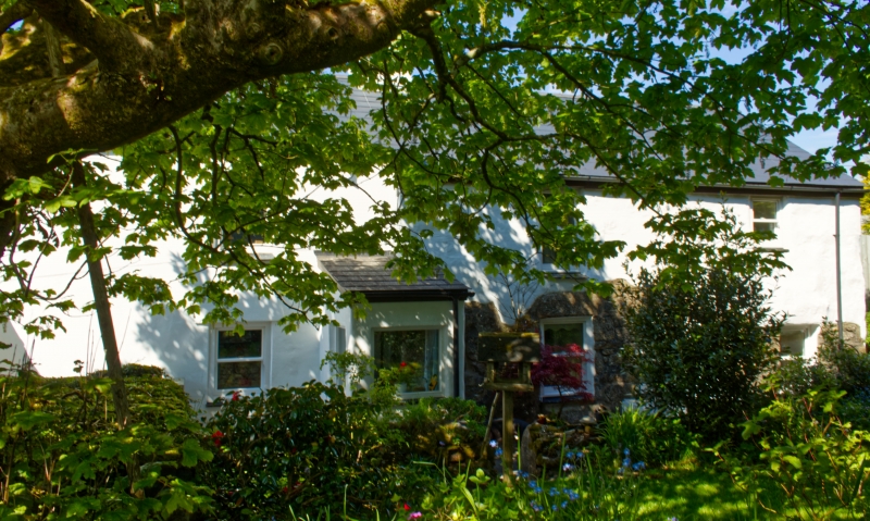
Chapel Hill Farmhouse
II
Farmhouse. Perhaps C17 in origin, enlarged and altered in C19. Slobbered
uncoursed granite rubble, with some brick, roofs of slurried slate and slate on 2
levels. Plan consisting of 3 elements, on an east-west axis: the earliest is the
western half, mostly occupied by an integral byre with outshuts, entered through
the west gable wall, with a short domestic bay linked to the C19 additions; these
have a square plan formed by two 2-unit elements built back-to-back, with a
small wing attached at right-angles to the north-east corner. The western half is
of 2 low storeys; the west gable wall with its outshuts is very wide and has 3
square-headed doorways at ground floor (one offset left of centre and one to
each outshut), and a flight of 7 stone steps at right-angles leading to a round-
headed loft doorway offset to the right; on the north side the outshut (which
appears to be an addition) covers only the byre, the domestic bay to the right
has a doorway under a primitive slab porch with a water tank on top, one
altered window on each floor to the left, and a short tapered chimney on the
ridge; the larger outshut on the south side has a catslide roof carried down to a
low level, a doorway in line with the domestic bay, and a small horizontal 3-
pane fixed window to the right. The C19 additions are of 2 higher storeys and
each of 2 bays; that on the south side has a gabled porch offset left, 2 windows
on each floor, sashed without glazing bars, and gable chimneys, that on the left
square with a tapered cap; that on the north side has a doorway to the 2nd bay,
two 4-pane sashes on each floor, and gable chimneys. The small single-storey
wing attached to the left corner is of brick, has a doorway at the junction, a
large round-headed window to the left, a smaller one in the gable wall, and a
chimney at the rear left corner. Interior not inspected. Unoccupied at time of
survey (1988).
Listing NGR: SW7148239401
This text is from the original listing, and may not necessarily reflect the current setting of the building.
External links are from the relevant listing authority and, where applicable, Wikidata. Wikidata IDs may be related buildings as well as this specific building. If you want to add or update a link, you will need to do so by editing the Wikidata entry.


Other nearby listed buildings