Approximate Location Map
Large Map »
Latitude: 54.5385 / 54°32'18"N
Longitude: -1.9282 / 1°55'41"W
OS Eastings: 404741
OS Northings: 515919
OS Grid: NZ047159
Mapcode National: GBR GHZY.BV
Mapcode Global: WHB4L.C611
Plus Code: 9C6WG3QC+CP
Entry Name: Todman Headstone 11 Metres South of Porch of Church of Holy Trinity
Listing Date: 28 October 1987
Grade: II
Source: Historic England
Source ID: 1310263
English Heritage Legacy ID: 111761
ID on this website: 101310263
Location: Holy Trinity Church, Startforth, County Durham, DL12
County: County Durham
Civil Parish: Startforth
Traditional County: Yorkshire
Lieutenancy Area (Ceremonial County): County Durham
Tagged with: Tombstone
NZ 0415 STARTFORTH HIGH STARTFORTH
(North side)
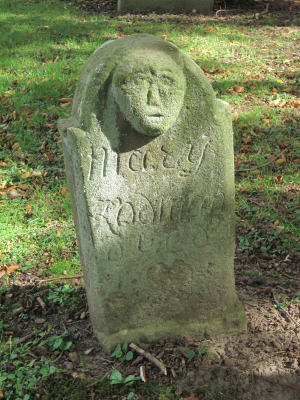
12/170 Todman headstone
11 metres south of
porch of Church
of Holy Trinity
GV II
Headstone, late C17 or C18. Cut sandstone. Stone with semicircular pedimented
top, 0.50 metre high. East face with death's head above florid initials;
west face with relief-carved face above inscription to Mary Todman.
Listing NGR: NZ0474115919
External links are from the relevant listing authority and, where applicable, Wikidata. Wikidata IDs may be related buildings as well as this specific building. If you want to add or update a link, you will need to do so by editing the Wikidata entry.


Other nearby listed buildings
