Latitude: 52.0299 / 52°1'47"N
Longitude: -0.8195 / 0°49'10"W
OS Eastings: 481086
OS Northings: 237486
OS Grid: SP810374
Mapcode National: GBR D06.PMB
Mapcode Global: VHDT5.R74R
Plus Code: 9C4X25HJ+W6
Entry Name: Whitehouse Farmhouse
Listing Date: 28 August 1975
Grade: II
Source: Historic England
Source ID: 1310462
English Heritage Legacy ID: 45889
ID on this website: 101310462
Location: Crownhill, Milton Keynes, Buckinghamshire, MK19
County: Milton Keynes
Civil Parish: Whitehouse
Traditional County: Buckinghamshire
Lieutenancy Area (Ceremonial County): Buckinghamshire
Church of England Parish: Stony Stratford St Mary and Giles
Church of England Diocese: Oxford
Tagged with: Farmhouse
SP 83 NW
3/103
SHENLEY CHURCH END
OAKHILL LANE (Calverton)
Whitehouse Farmhouse
28.8.75
II
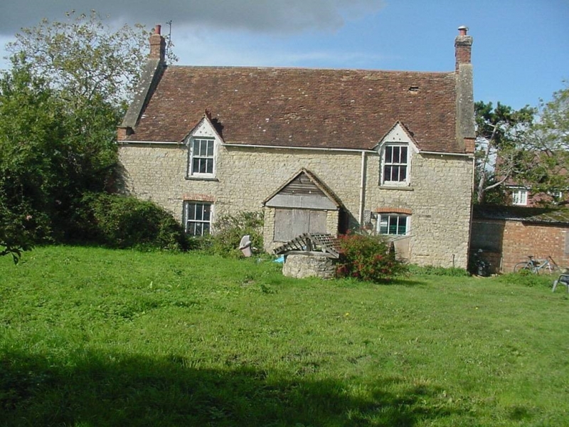
House. C18 altered. Rubble stone, once painted. Tiled roof replacing thatch, steep pitched gables with parapets and rebuilt kneelers, brick chimneys, 2 storeys, 2 bays of sash windows, the upper ones surmounted by small gables with crested ridges. Central doorway to E. side with gabled tiled porch.
Listing NGR: SP8108637486
External links are from the relevant listing authority and, where applicable, Wikidata. Wikidata IDs may be related buildings as well as this specific building. If you want to add or update a link, you will need to do so by editing the Wikidata entry.


Other nearby listed buildings