Approximate Location Map
Large Map »
Latitude: 51.6726 / 51°40'21"N
Longitude: -0.8668 / 0°52'0"W
OS Eastings: 478459
OS Northings: 197694
OS Grid: SU784976
Mapcode National: GBR C38.3PC
Mapcode Global: VHDVW.X7M5
Plus Code: 9C3XM4FM+27
Entry Name: Hillside
Listing Date: 4 July 1985
Grade: II
Source: Historic England
Source ID: 1310484
English Heritage Legacy ID: 46623
ID on this website: 101310484
Location: Radnage, Buckinghamshire, HP14
County: Buckinghamshire
Civil Parish: Radnage
Traditional County: Buckinghamshire
Lieutenancy Area (Ceremonial County): Buckinghamshire
Church of England Parish: Radnage
Church of England Diocese: Oxford
Tagged with: Building
RADNAGE TOWN END ROAD
SU 79 NE
2/144
Hillside
-
GV II
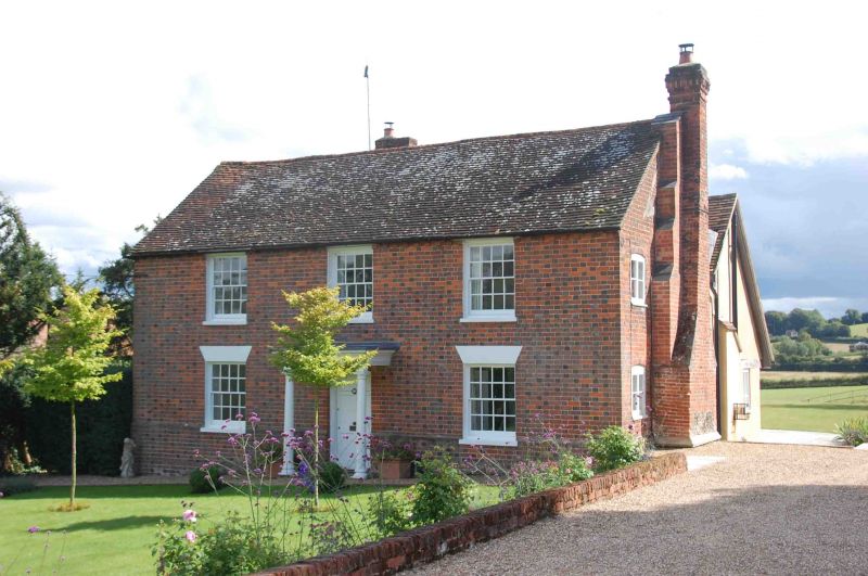
House. Early C19, incorporating older structure. Red and vitreous
chequer brick with brick plinth and dentil eaves. Old tile roof,
brick chimney to right. Right gable shows traces of roof truss of
older building. 2 storeys, 3 bays. 4-pane sashes, those to ground
floor with rendered and whitewashed voussoir heads. Central 6-panel door
in later wooden porch with entablature hood on slender Doric columns.
C20 extensions to rear.
Listing NGR: SU7845997694
External links are from the relevant listing authority and, where applicable, Wikidata. Wikidata IDs may be related buildings as well as this specific building. If you want to add or update a link, you will need to do so by editing the Wikidata entry.


Other nearby listed buildings
