Latitude: 51.887 / 51°53'13"N
Longitude: -0.5782 / 0°34'41"W
OS Eastings: 497949
OS Northings: 221892
OS Grid: SP979218
Mapcode National: GBR F3L.QM2
Mapcode Global: VHFRB.XTPT
Plus Code: 9C3XVCPC+QP
Entry Name: 213, Castle Hill Road
Listing Date: 26 September 1980
Grade: II
Source: Historic England
Source ID: 1310909
English Heritage Legacy ID: 36161
ID on this website: 101310909
Location: Middle End, Central Bedfordshire, LU6
County: Central Bedfordshire
Civil Parish: Totternhoe
Built-Up Area: Totternhoe
Traditional County: Bedfordshire
Lieutenancy Area (Ceremonial County): Bedfordshire
Church of England Parish: Totternhoe
Church of England Diocese: St.Albans
Tagged with: Building Thatched building
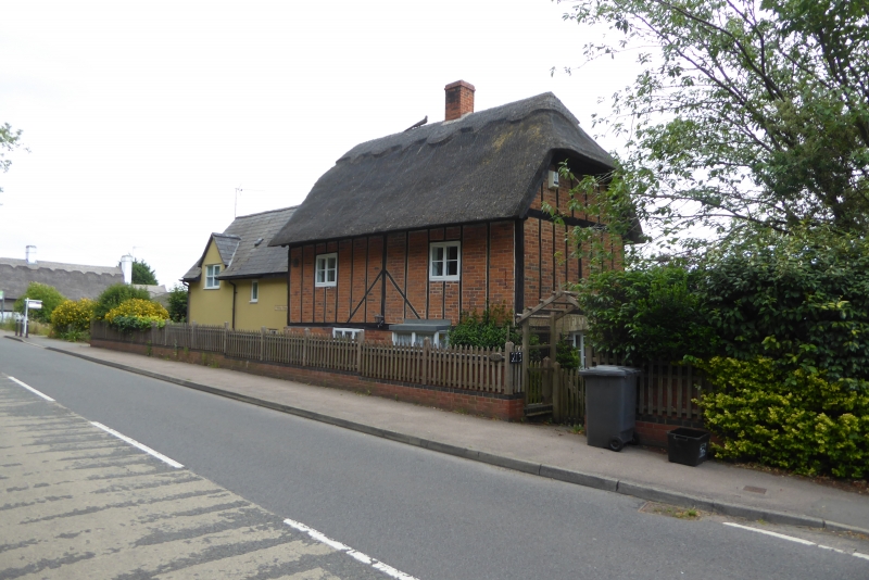
1.
5125 TOTTERNHOE CASTLE HILL ROAD
(south side)
Middle End
No 213
SP 9721 31/395
II
2.
C17 with later alterations. Gault brick ground floor, timber-framed first
floor with red brick nogging. Thatched roof Two casement windows. Modern
bay to right hand ground floor.
Listing NGR: SP9794921892
External links are from the relevant listing authority and, where applicable, Wikidata. Wikidata IDs may be related buildings as well as this specific building. If you want to add or update a link, you will need to do so by editing the Wikidata entry.


Other nearby listed buildings