Latitude: 54.2856 / 54°17'8"N
Longitude: -2.5762 / 2°34'34"W
OS Eastings: 362584
OS Northings: 487928
OS Grid: SD625879
Mapcode National: GBR BLGW.1H
Mapcode Global: WH949.DJGY
Plus Code: 9C6V7CPF+6G
Entry Name: Milestone at SD 625 879
Listing Date: 21 February 1989
Grade: II
Source: Historic England
Source ID: 1311780
English Heritage Legacy ID: 75731
ID on this website: 101311780
Location: Westmorland and Furness, Cumbria, LA6
County: Westmorland and Furness
District: South Lakeland
Civil Parish: Middleton
Traditional County: Westmorland
Lieutenancy Area (Ceremonial County): Cumbria
Church of England Parish: Kirkby Lonsdale Team Ministry
Church of England Diocese: Carlisle
Tagged with: Milestone
SD 68 NW MIDDLETON A683 (West side)
13/151 Milestone at SD 625 879
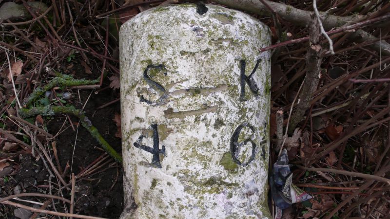
II Milestone. Early C19. Painted stone. Semi-circular on plan, on square base with broaches to angles. Inscribed: "S:KL/4:6¾" (S = Sedbergh; KL = Kirkby Lonsdale). Placed on the Sedbergh to Greta Bridge turnpike road 1762.
Listing NGR: SD6258487928
External links are from the relevant listing authority and, where applicable, Wikidata. Wikidata IDs may be related buildings as well as this specific building. If you want to add or update a link, you will need to do so by editing the Wikidata entry.


Other nearby listed buildings