Latitude: 51.3191 / 51°19'8"N
Longitude: -2.9808 / 2°58'51"W
OS Eastings: 331742
OS Northings: 158236
OS Grid: ST317582
Mapcode National: GBR J6.X2X8
Mapcode Global: VH7CR.930L
Plus Code: 9C3V8299+JM
Entry Name: Remains of Windmill
Listing Date: 15 November 1982
Grade: II
Source: Historic England
Source ID: 1311977
English Heritage Legacy ID: 33252
ID on this website: 101311977
Location: Uphill, North Somerset, BS23
County: North Somerset
Civil Parish: Weston-super-Mare
Built-Up Area: Weston-Super-Mare
Traditional County: Somerset
Lieutenancy Area (Ceremonial County): Somerset
Tagged with: Windmill
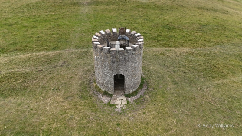
UPHILL WAY 1. 5121 Remains of windmill ST 3058-3158 12/69 15.11.82 II 2. Early C19. Limestone rubble, circular one-storey tower, round headed doorway on N side and round headed window on S side. Crenellated parapet. Converted to observatory in late C19 but now derelict. (See: BIAS Journal Vol 6).
Listing NGR: ST3174258236
External links are from the relevant listing authority and, where applicable, Wikidata. Wikidata IDs may be related buildings as well as this specific building. If you want to add or update a link, you will need to do so by editing the Wikidata entry.


Other nearby listed buildings