Approximate Location Map
Large Map »
Latitude: 54.6684 / 54°40'6"N
Longitude: -2.7596 / 2°45'34"W
OS Eastings: 351105
OS Northings: 530631
OS Grid: NY511306
Mapcode National: GBR 9G5G.B9
Mapcode Global: WH814.LX3J
Plus Code: 9C6VM69R+85
Entry Name: Bank House
Listing Date: 9 February 1983
Grade: II
Source: Historic England
Source ID: 1312057
English Heritage Legacy ID: 72845
ID on this website: 101312057
Location: Townhead, Westmorland and Furness, Cumbria, CA11
County: Cumbria
District: Eden
Civil Parish: Penrith
Built-Up Area: Penrith
Traditional County: Cumberland
Lieutenancy Area (Ceremonial County): Cumbria
Church of England Parish: Penrith Christ Church
Church of England Diocese: Carlisle
Tagged with: House
1.
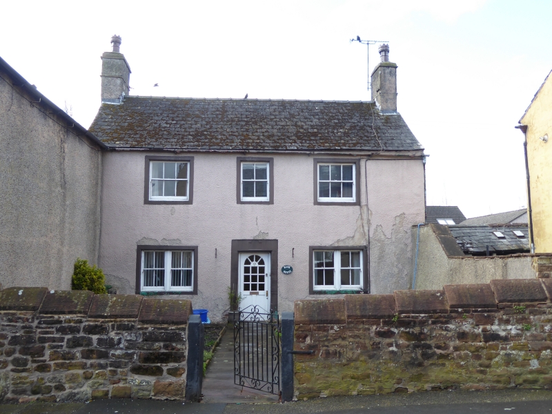
5165 FOSTER STREET
Bank House
NY 5130 2/87
II
2.
Early C18. Pebbledash over stone, with stone architraves, and stone roof at
rear. Two storeys. Door lintel has panel which probably had date but now
illegible. Two double sash windows on ground floor and 3 sashes above.
Listing NGR: NY5110530631
External links are from the relevant listing authority and, where applicable, Wikidata. Wikidata IDs may be related buildings as well as this specific building. If you want to add or update a link, you will need to do so by editing the Wikidata entry.


Other nearby listed buildings
