Approximate Location Map
Large Map »
Latitude: 54.4903 / 54°29'25"N
Longitude: -3.5897 / 3°35'23"W
OS Eastings: 297120
OS Northings: 511716
OS Grid: NX971117
Mapcode National: GBR 3JCJ.M3
Mapcode Global: WH5ZF.TDSH
Plus Code: 9C6RFCR6+44
Entry Name: Orchard House
Listing Date: 9 August 1984
Grade: II
Source: Historic England
Source ID: 1312348
English Heritage Legacy ID: 76186
ID on this website: 101312348
Location: St Bees, Cumberland, Cumbria, CA27
County: Cumbria
District: Copeland
Civil Parish: St. Bees
Built-Up Area: St Bees
Traditional County: Cumberland
Lieutenancy Area (Ceremonial County): Cumbria
Church of England Parish: St Bees
Church of England Diocese: Carlisle
Tagged with: House
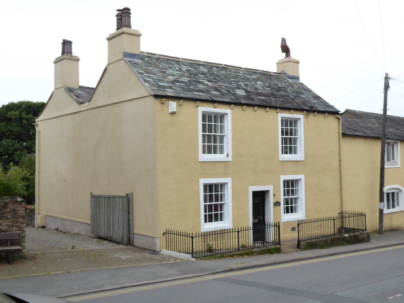
NX 91 SE ST BEES MAIN STREET (West
side) St Bees
12/88 No 115 (Orchard
House)
II
House, late C18/early C19. Pebble-dashed rubble. Parallel roofs with rendered
end chimneys; graduated slate to front, welsh slate to rear. Cast-iron moulded
gutter on brackets. Symmetrical 2-storey, 3-bay front has central part-glazed
door in stone surround; two 16-pane sashes in stone surrounds to each floor.
Listing NGR: NX9712011716
External links are from the relevant listing authority and, where applicable, Wikidata. Wikidata IDs may be related buildings as well as this specific building. If you want to add or update a link, you will need to do so by editing the Wikidata entry.


Other nearby listed buildings
