Latitude: 51.6094 / 51°36'33"N
Longitude: -2.5262 / 2°31'34"W
OS Eastings: 363655
OS Northings: 190191
OS Grid: ST636901
Mapcode National: GBR JT.9WST
Mapcode Global: VH87X.5TB4
Plus Code: 9C3VJF5F+PG
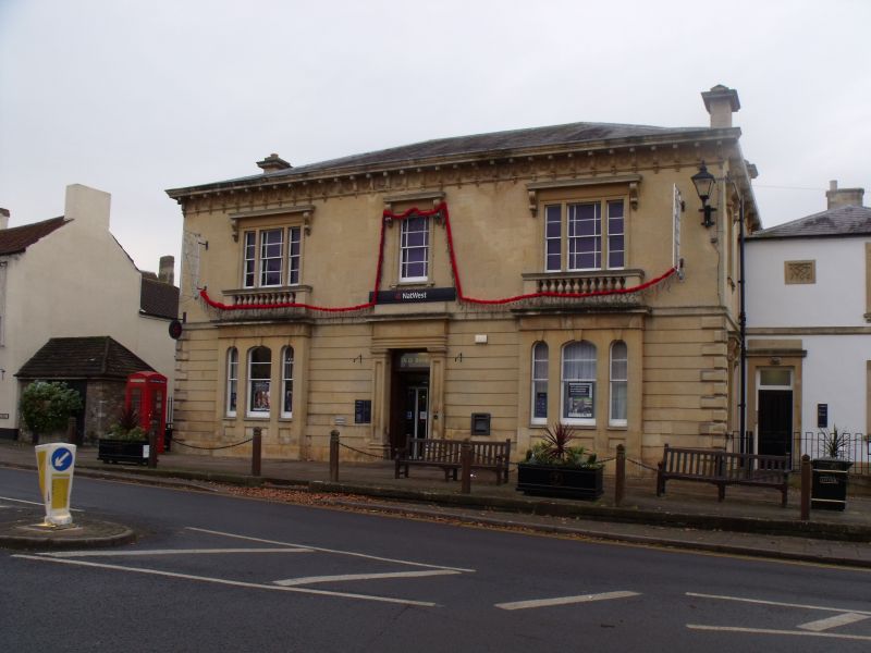
Entry Name: Former National Westminster Bank
Listing Date: 17 December 1984
Grade: II
Source: Historic England
Source ID: 1312559
English Heritage Legacy ID: 35008
ID on this website: 101312559
Location: Thornbury, South Gloucestershire, BS35
County: South Gloucestershire
Civil Parish: Thornbury
Built-Up Area: Thornbury
Traditional County: Gloucestershire
Lieutenancy Area (Ceremonial County): Gloucestershire
Church of England Parish: Thornbury St Mary
Church of England Diocese: Gloucester
Tagged with: Bank building
This list entry was subject to a Minor Amendment on 17 June 2025 to amend the name and address and to reformat the text to current standards
ST 6390
4/104
THORNBURY
THE PLAIN (west side)
No 16, Former National Westminster Bank
(Formerly listed as No 16 (National Westminster Bank))
GV
II
Circa 1860. Italianate. Ashlar, chanelled rustication on ground floor, quoins. Hipped slate roof, overhanging bracketted eaves. Decorative frieze. Ashlar stacks with cornices. Two storeys. Three windows, three- and one-light marginal glazing bar sashes with architraves and hoods on brackets. Ground floor: three-light round and segmental headed windows in slightly advanced bays with balustrade above. Central panelled door between panelled pilasters and plain entablature above. To right (north) is an attached rendered, two storey wing. Hipped slate roof. One glazing bar sash window and panel containing date 1706 surmounted by Stafford badge? Possibly part of earlier public house.
Listing NGR: ST6365590191
External links are from the relevant listing authority and, where applicable, Wikidata. Wikidata IDs may be related buildings as well as this specific building. If you want to add or update a link, you will need to do so by editing the Wikidata entry.


Other nearby listed buildings