Latitude: 51.4736 / 51°28'24"N
Longitude: -0.8193 / 0°49'9"W
OS Eastings: 482099
OS Northings: 175618
OS Grid: SU820756
Mapcode National: GBR D6Z.HPT
Mapcode Global: VHDWW.R776
Plus Code: 9C3XF5FJ+C7
Entry Name: The Plough Public House
Listing Date: 25 March 1955
Grade: II
Source: Historic England
Source ID: 1313038
English Heritage Legacy ID: 41005
ID on this website: 101313038
Location: West End, Windsor and Maidenhead, Berkshire, RG10
County: Windsor and Maidenhead
Civil Parish: Waltham St. Lawrence
Traditional County: Berkshire
Lieutenancy Area (Ceremonial County): Berkshire
Church of England Parish: Waltham
Church of England Diocese: Oxford
Tagged with: Pub
WALTHAM ST LAWRENCE WEST END SU 87 NW
8/11 The Plough Public House 25.3.55 G.V. II
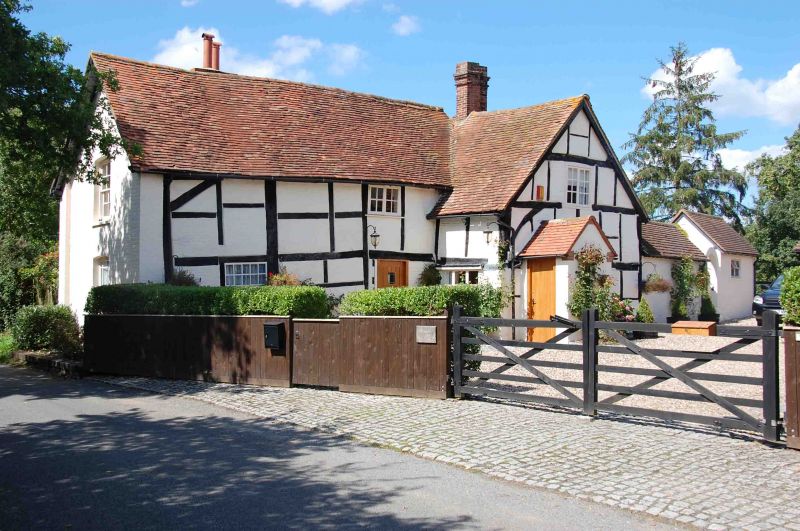
Cottage, now public house. Late C15, altered and extended late C19. Timber frame, painted brick infill; part brick. Old tile gabled roofs. L-plan of 3x2 framed bays, with extensions on north and west. 2 storeys. 2 large chimneys, that on the extension has tall clay pots. C19 casement windows, C19 sash windows to extension. Entrance (east) front: irregular, scattered windows. Gable projecting on right with small gabled projection on ground floor left side. 2-light window first floor, small 2-light window ground floor. Left hand part; one small 2-light window on first floor, one fixed window with small panes and shutters in left of ground floor, half-glazed entrance door on right, near internal angle. Interior: some timber frame exposed on first floor.
Listing NGR: SU8209975618
External links are from the relevant listing authority and, where applicable, Wikidata. Wikidata IDs may be related buildings as well as this specific building. If you want to add or update a link, you will need to do so by editing the Wikidata entry.


Other nearby listed buildings