Latitude: 53.1999 / 53°11'59"N
Longitude: -2.1433 / 2°8'35"W
OS Eastings: 390525
OS Northings: 366993
OS Grid: SJ905669
Mapcode National: GBR 121.JXJ
Mapcode Global: WHBBW.1TNQ
Plus Code: 9C5V5VX4+XM
Entry Name: Macclesfield Canal Bosley Lock Number 1 and Spillway
Listing Date: 14 June 1984
Grade: II
Source: Historic England
Source ID: 1313054
English Heritage Legacy ID: 58124
Also known as: Bosley Top Lock
ID on this website: 101313054
Location: Cheshire East, Cheshire, CW12
County: Cheshire East
Civil Parish: Bosley
Traditional County: Cheshire
Lieutenancy Area (Ceremonial County): Cheshire
Church of England Parish: Bosley St Mary the Virgin
Church of England Diocese: Chester
Tagged with: Lock
BOSLEY C.P. MACCLESFIELD CANAL SJ 96 NW
1/13 Bosley Lock Number 1 and Spillway
GV II
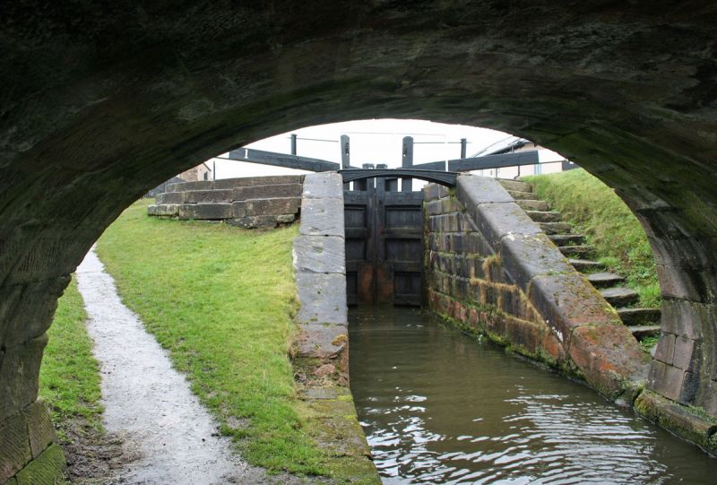
Canal lock, 1831, William Crosley engineer. Rusticated red gritstone walls to lock, ashlar to spillway; brick patching to lock sides. Semi-circular upper end to lock basin. Stepped quadrant retaining wall to bank west of lock: flight of stone steps to east. Cambered footbridge of cast iron across lock entrance, with later plain steel tubular rail. Two pairs of timber lock gates. Curved wing walls above lock; straight walls below to Bridge 54 (q.v.). Stone-walled spillway west of lock.
Listing NGR: SJ9052566992
External links are from the relevant listing authority and, where applicable, Wikidata. Wikidata IDs may be related buildings as well as this specific building. If you want to add or update a link, you will need to do so by editing the Wikidata entry.


Other nearby listed buildings