Approximate Location Map
Large Map »
Latitude: 53.9038 / 53°54'13"N
Longitude: -1.6918 / 1°41'30"W
OS Eastings: 420345
OS Northings: 445342
OS Grid: SE203453
Mapcode National: GBR JRM9.JB
Mapcode Global: WHC8X.Z4JK
Plus Code: 9C5WW835+G7
Entry Name: 65, Bondgate
Listing Date: 8 July 1974
Grade: II
Source: Historic England
Source ID: 1313357
English Heritage Legacy ID: 341363
ID on this website: 101313357
Location: Otley, Leeds, West Yorkshire, LS21
County: Leeds
Civil Parish: Otley
Built-Up Area: Otley
Traditional County: Yorkshire
Lieutenancy Area (Ceremonial County): West Yorkshire
Church of England Parish: Otley All Saints
Church of England Diocese: Leeds
Tagged with: Building
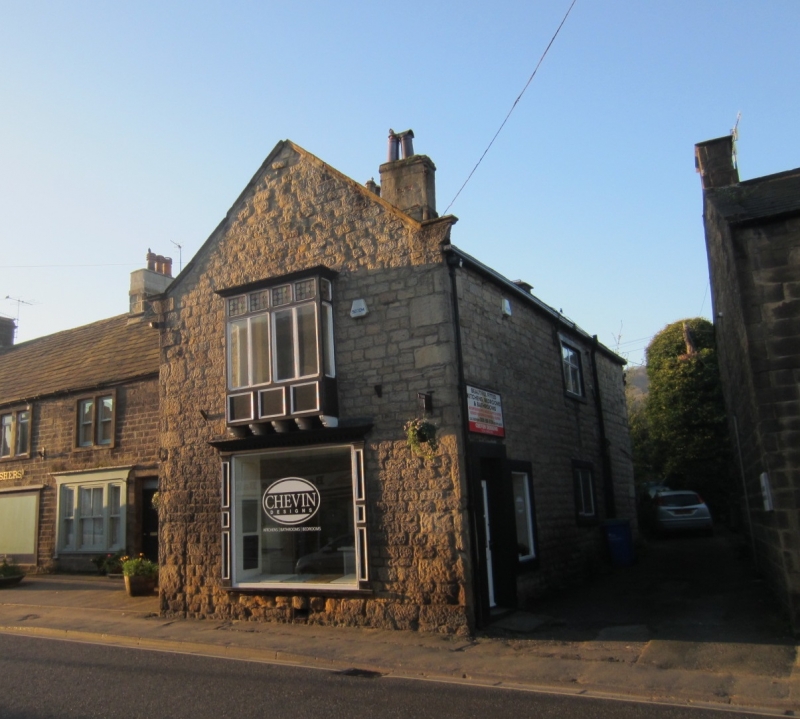
Bondgate
1.
1480
(South Side)
No 65
SE 2045 1/105
II GV
2.
C18 or C17 origin. Two storeys in stone. Gable end with kneelers to
road, oriel and shop front of Cl9. Side elevation has one two-light window
with glazing bars on the first floor and two irregular windows on ground
floor, stone architraves, Two doors, stone architraves.
Nos 65 to 75 (odd) form a group.
Listing NGR: SE2034545342
External links are from the relevant listing authority and, where applicable, Wikidata. Wikidata IDs may be related buildings as well as this specific building. If you want to add or update a link, you will need to do so by editing the Wikidata entry.


Other nearby listed buildings
