Latitude: 53.9062 / 53°54'22"N
Longitude: -1.6943 / 1°41'39"W
OS Eastings: 420178
OS Northings: 445598
OS Grid: SE201455
Mapcode National: GBR JRL8.ZH
Mapcode Global: WHC8X.Y2BS
Plus Code: 9C5WW844+F7
Entry Name: 15, Clapgate
Listing Date: 8 July 1974
Grade: II
Source: Historic England
Source ID: 1313385
English Heritage Legacy ID: 341408
ID on this website: 101313385
Location: Otley, Leeds, West Yorkshire, LS21
County: Leeds
Civil Parish: Otley
Built-Up Area: Otley
Traditional County: Yorkshire
Lieutenancy Area (Ceremonial County): West Yorkshire
Church of England Parish: Otley All Saints
Church of England Diocese: Leeds
Tagged with: Building
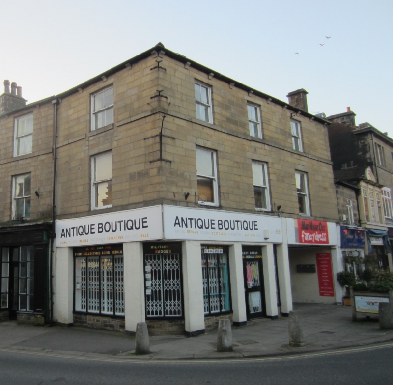
Clapgate
1.
1480
(South Side)
No 15
SE 2105 1/144
II GV
2.
Mid C19. 3 storeys in stone. Manor Square elevation of 3 windows, some
glazing bars, band continues cills. Modillion eaves cornice. Modern
shop front. Included solely as an important member of a group.
Nos 15 to 27 (odd) form a group. No 15 also forms a group with Nos 5
to 13 (odd) Manor Square.
Listing NGR: SE2017845598
External links are from the relevant listing authority and, where applicable, Wikidata. Wikidata IDs may be related buildings as well as this specific building. If you want to add or update a link, you will need to do so by editing the Wikidata entry.


Other nearby listed buildings