Approximate Location Map
Large Map »
Latitude: 53.5833 / 53°34'59"N
Longitude: -1.7911 / 1°47'27"W
OS Eastings: 413928
OS Northings: 409649
OS Grid: SE139096
Mapcode National: GBR HWY0.17
Mapcode Global: WHCBF.G6BB
Plus Code: 9C5WH6M5+8H
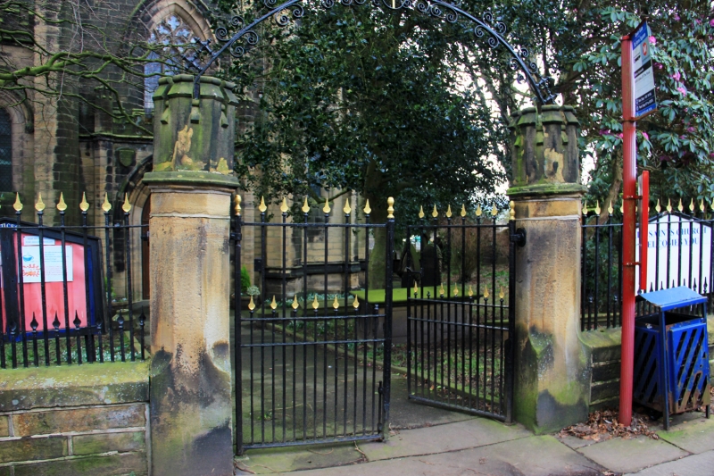
Entry Name: Gate Piers, Gates and Overthrow to Church of All Saints
Listing Date: 4 August 1983
Grade: II
Source: Historic England
Source ID: 1313611
English Heritage Legacy ID: 340579
ID on this website: 101313611
Location: Netherthong, Kirklees, West Yorkshire, HD9
County: Kirklees
Civil Parish: Holme Valley
Built-Up Area: Holmfirth
Traditional County: Yorkshire
Lieutenancy Area (Ceremonial County): West Yorkshire
Church of England Parish: Netherthong All Saints
Church of England Diocese: Leeds
Tagged with: Gatepost
SE 1309
11/351
TOWN GATE
(Netherthong)
Gate Piers, Gates and Overthrow to Church of All Saints
GV
II
Gate piers and gates. Circa 1830. Two 8-sided stone gate piers with crenellated
copings. Iron gates and overthrow.
Listing NGR: SE1392809649
External links are from the relevant listing authority and, where applicable, Wikidata. Wikidata IDs may be related buildings as well as this specific building. If you want to add or update a link, you will need to do so by editing the Wikidata entry.


Other nearby listed buildings
