Approximate Location Map
Large Map »
Latitude: 53.6617 / 53°39'42"N
Longitude: -1.836 / 1°50'9"W
OS Eastings: 410937
OS Northings: 418370
OS Grid: SE109183
Mapcode National: GBR HVM3.93
Mapcode Global: WHCB0.R7X6
Plus Code: 9C5WM567+MJ
Entry Name: 80 and 82, Cowrakes Road
Listing Date: 29 September 1978
Grade: II
Source: Historic England
Source ID: 1313819
English Heritage Legacy ID: 339735
ID on this website: 101313819
Location: Salendine Nook, Kirklees, West Yorkshire, HD3
County: Kirklees
Electoral Ward/Division: Lindley
Parish: Non Civil Parish
Built-Up Area: Huddersfield
Traditional County: Yorkshire
Lieutenancy Area (Ceremonial County): West Yorkshire
Church of England Parish: Birchencliffe St Philip the Apostle
Church of England Diocese: Leeds
Tagged with: Building
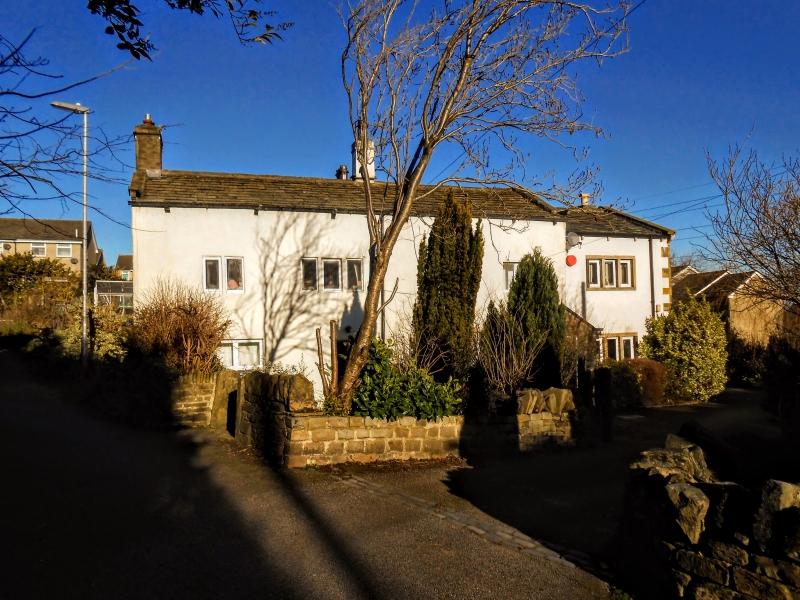
COWRAKES ROAD
1.
5113
(North Side)
Nos 80 and 82
SE 1018 20/405
II
2.
C18. Rendered. Pitched stone slate roof, catslide to rear. Coped gables
on cut kneelers. 2 storeys. One 3-light and three 2-light (No 80s mullions
removed) on 1st floor. Ground floor windows altered.
Listing NGR: SE1093718370
External links are from the relevant listing authority and, where applicable, Wikidata. Wikidata IDs may be related buildings as well as this specific building. If you want to add or update a link, you will need to do so by editing the Wikidata entry.


Other nearby listed buildings
