Approximate Location Map
Large Map »
Latitude: 53.624 / 53°37'26"N
Longitude: -1.7785 / 1°46'42"W
OS Eastings: 414750
OS Northings: 414188
OS Grid: SE147141
Mapcode National: GBR JV0J.RM
Mapcode Global: WHCB7.N5BL
Plus Code: 9C5WJ6FC+JJ
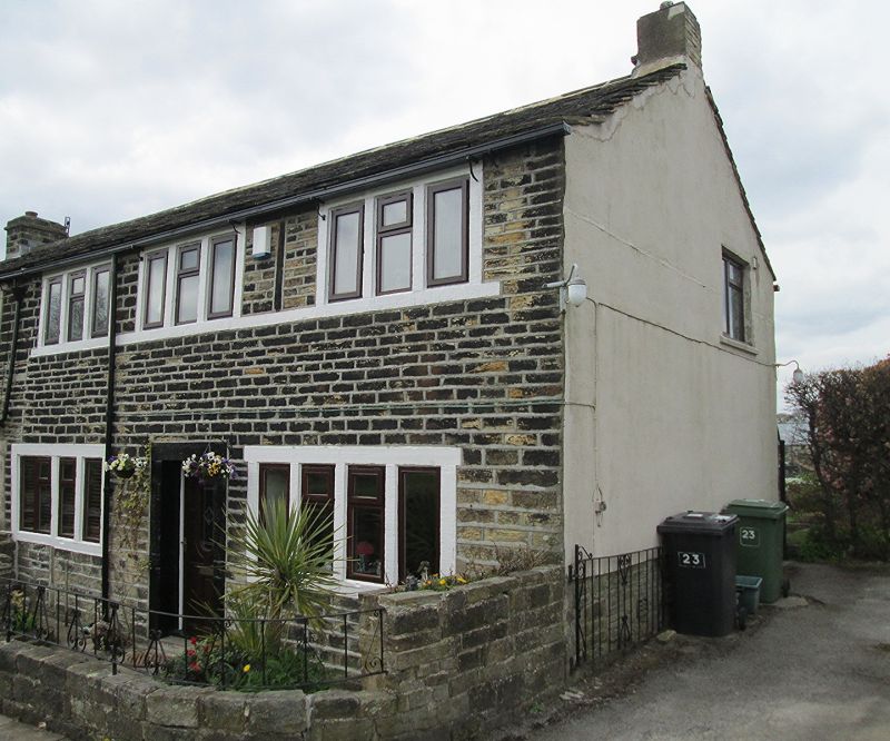
Entry Name: 23, Hall Bower
Listing Date: 29 September 1978
Grade: II
Source: Historic England
Source ID: 1313886
English Heritage Legacy ID: 339969
ID on this website: 101313886
Location: Hall Bower, Kirklees, West Yorkshire, HD4
County: Kirklees
Electoral Ward/Division: Newsome
Parish: Non Civil Parish
Built-Up Area: Huddersfield
Traditional County: Yorkshire
Lieutenancy Area (Ceremonial County): West Yorkshire
Church of England Parish: Newsome and Armitage Bridge St John the Evangelist
Church of England Diocese: Leeds
Tagged with: Building
HALL BOWER
1.
5113
No 23
SE 1414 44/643
II GV
2.
C18 or early C19. Hammer-dressed stone. Pitched stone slate roof. 2 storeys.
Three 3-light stone mullioned windows on 1st floor, two 4-light stone mullioned
windows on ground floor.
Listing NGR: SE1475014188
External links are from the relevant listing authority and, where applicable, Wikidata. Wikidata IDs may be related buildings as well as this specific building. If you want to add or update a link, you will need to do so by editing the Wikidata entry.


Other nearby listed buildings
