Latitude: 53.4081 / 53°24'29"N
Longitude: -1.1474 / 1°8'50"W
OS Eastings: 456775
OS Northings: 390478
OS Grid: SK567904
Mapcode National: GBR NYF1.D0
Mapcode Global: WHDDN.BLVN
Plus Code: 9C5WCV53+62
Entry Name: Farmbuilding Approximately 100 Metres to North of Sandbeck Park Stables
Listing Date: 1 April 1987
Grade: II
Source: Historic England
Source ID: 1314666
English Heritage Legacy ID: 335936
ID on this website: 101314666
Location: Rotherham, South Yorkshire, S66
County: Rotherham
Civil Parish: Maltby
Traditional County: Yorkshire
Lieutenancy Area (Ceremonial County): South Yorkshire
Church of England Parish: Maltby
Church of England Diocese: Sheffield
Tagged with: Agricultural structure
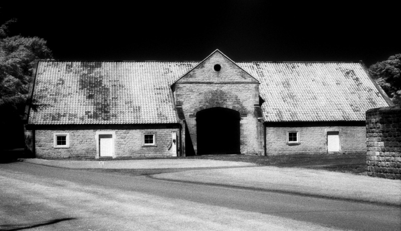
MALTBY SANDBECK PARK SK59SE 4/61 Farmbuilding approximately 100 metres to north of Sandbeck Park Stables GV II Barn and cowhouse now disused. Mid C18. For the Sandbeck Park estate. Coursed rubble limestone, pantile roof (partly removed). 2-storey, 7-bay barn with central waggon entrance flanked by front outshuts under catslide roofs. Large quoins. Waggon entrance has projecting imposts and keystone to shallow 2-centred arch set beneath pedimented gable with oculus in tympanum. Outshut on right: central doorway with bonded ashlar surround flanked by square windows with plain ashlar surrounds. Outshut on left: altered openings; now has garage doors on left and door and window in ashlar surround to right. Right end of roof now without pantile covering and with sane rafters removed over outshut. Shaped kneelers and gable copings. Rear: altered and undergoing reconstruction; large Diocletian window on right. Included for group value.
Listing NGR: SK5677590478
External links are from the relevant listing authority and, where applicable, Wikidata. Wikidata IDs may be related buildings as well as this specific building. If you want to add or update a link, you will need to do so by editing the Wikidata entry.


Other nearby listed buildings