Latitude: 53.4306 / 53°25'50"N
Longitude: -1.1114 / 1°6'41"W
OS Eastings: 459134
OS Northings: 393011
OS Grid: SK591930
Mapcode National: GBR NXPR.5Y
Mapcode Global: WHDDN.W1XC
Plus Code: 9C5WCVJQ+6C
Entry Name: 6, Church Lane
Listing Date: 22 January 1981
Grade: II
Source: Historic England
Source ID: 1314736
English Heritage Legacy ID: 334317
ID on this website: 101314736
Location: Tickhill, Doncaster, South Yorkshire, DN11
County: Doncaster
Civil Parish: Tickhill
Built-Up Area: Tickhill
Traditional County: Yorkshire
Lieutenancy Area (Ceremonial County): South Yorkshire
Church of England Parish: Tickhill St Mary
Church of England Diocese: Sheffield
Tagged with: Building
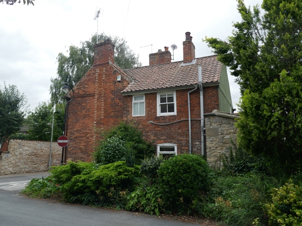
CHURCH LANE 1. ----------- 5096 No 6
SK 5993 2/71
II
2. C18. Brown brick. Pantiled roof. Two storeys. Brick band. Brick modillioned eaves cornice. Two bays: flush-framed cased sashes.
Listing NGR: SK5913493011
External links are from the relevant listing authority and, where applicable, Wikidata. Wikidata IDs may be related buildings as well as this specific building. If you want to add or update a link, you will need to do so by editing the Wikidata entry.


Other nearby listed buildings