Latitude: 54.1267 / 54°7'35"N
Longitude: -1.5729 / 1°34'22"W
OS Eastings: 428007
OS Northings: 470173
OS Grid: SE280701
Mapcode National: GBR KNGQ.8G
Mapcode Global: WHC7T.TJ5S
Plus Code: 9C6W4CGG+MR
Entry Name: Rough Bridge Approximately 100 Metres South-East of Lindrick Gate
Listing Date: 11 June 1986
Grade: II
Source: Historic England
Source ID: 1315266
English Heritage Legacy ID: 331053
ID on this website: 101315266
Location: North Yorkshire, HG4
County: North Yorkshire
District: Harrogate
Civil Parish: Lindrick with Studley Royal and Fountains
Traditional County: Yorkshire
Lieutenancy Area (Ceremonial County): North Yorkshire
Tagged with: Bridge
SE 27 SE LINDRICK AND STUDLEY STUDLEY PARK ROYAL AND FOUNTAINS
5/49 Rough Bridge approximately 100 metres south-east of Lindrick Gate
GV II
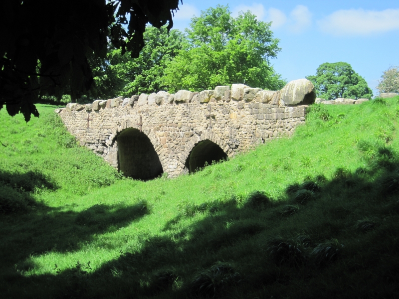
Bridge. Probably mid C18, for John or William Aislabie of Studley Royal House. Gritstone and limestone rubble. 2 round arches, one wide and one narrow. Parapet of massive boulders, roughly-dressed on inner face. The soffits are rendered with cement and lined to imitate blocks, probably C20. The bridge carried the path between Studley Royal House (demolished) and the large kitchen gardens and greenhouses which surrounded Wheatbrig House (qv) over the Dale, a narrow wooded dry valley which links the Lindrick Gate and the Ripon drive. The plan is very similar to Galand Bridge, Markington with Wallerthwaite (qv) on the south side of the Park close to Fountains Abbey (qv).
Listing NGR: SE2800770173
External links are from the relevant listing authority and, where applicable, Wikidata. Wikidata IDs may be related buildings as well as this specific building. If you want to add or update a link, you will need to do so by editing the Wikidata entry.


Other nearby listed buildings