Latitude: 54.011 / 54°0'39"N
Longitude: -1.47 / 1°28'12"W
OS Eastings: 434828
OS Northings: 457355
OS Grid: SE348573
Mapcode National: GBR LQ51.JX
Mapcode Global: WHD9L.DF7X
Plus Code: 9C6W2G6H+CX
Entry Name: 128, 130, 132, High Street
Listing Date: 15 May 1968
Grade: II
Source: Historic England
Source ID: 1315629
English Heritage Legacy ID: 330817
ID on this website: 101315629
Location: Tentergate, North Yorkshire, HG5
County: North Yorkshire
District: Harrogate
Civil Parish: Knaresborough
Built-Up Area: Knaresborough
Traditional County: Yorkshire
Lieutenancy Area (Ceremonial County): North Yorkshire
Church of England Parish: Knaresborough
Church of England Diocese: Leeds
Tagged with: Building
SE 3457 KNARESBOROUGH HIGH STREET (north side)
6/148 Nos 128, 130,132 15.5.68 GV II
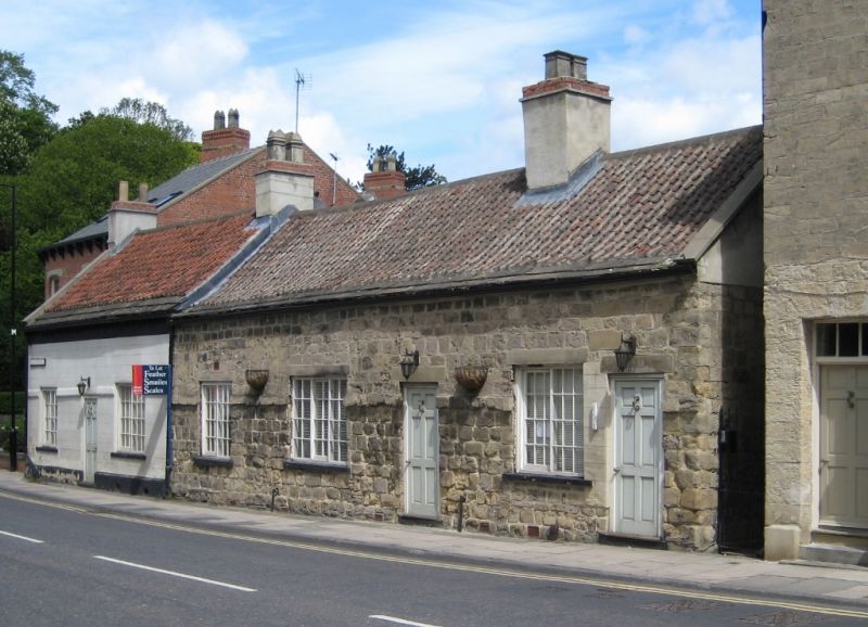
Row of 3 houses. C17 - C18 with C20 restoration. Coursed squared limestone, no 132 rendered, pantile roof with 3 or 4 eaves courses of stone slates. 1 storey with attics, 3 cells. Plinth. C20 glazed doors; side- sliding sashes throughout. No 128 has 2-light window of 24 panes to left of door; no 130 has 3-light and a 2-light window, each of 24 panes, to left of door. No 132 has flanking 2-light, 24-pane windows. Projecting band below lintel level of windows. Eaves line of no 132 slightly higher than that of nos 128 and 130. Large rendered ridge stack between nos 128 and 130; end stacks to no 132. Rear: short stone-built wings at right angles to nos 130 and 132, possibly originals. Extension to rear of no 128 has ridge line parallel to main front and is of later build. Beams and wide fireplace to no 132 not seen at resurvey.
Listing NGR: SE3482857355
External links are from the relevant listing authority and, where applicable, Wikidata. Wikidata IDs may be related buildings as well as this specific building. If you want to add or update a link, you will need to do so by editing the Wikidata entry.


Other nearby listed buildings