Latitude: 54.2805 / 54°16'49"N
Longitude: -0.872 / 0°52'19"W
OS Eastings: 473538
OS Northings: 487796
OS Grid: SE735877
Mapcode National: GBR QLCY.09
Mapcode Global: WHF9N.KNZV
Plus Code: 9C6X74JH+65
Entry Name: The Firs
Listing Date: 14 July 1955
Grade: II
Source: Historic England
Source ID: 1315915
English Heritage Legacy ID: 328363
ID on this website: 101315915
Location: Appleton-le-Moors, North Yorkshire, YO62
County: North Yorkshire
District: Ryedale
Civil Parish: Appleton-le-Moors
Traditional County: Yorkshire
Lieutenancy Area (Ceremonial County): North Yorkshire
Tagged with: Architectural structure
SE 7287-7387 APPLETON-LE-MOORS VILLAGE STREET (west side)
8/5 The Firs 14/7/55 GV II
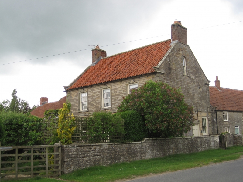
House, Mid C18, Herring-bone-tooled limestone to front, coursed rubble to rear; sandstone dressings; pantile roof; brick stacks. Central staircase plan, 1½ rooms deep. 2-storey, symmetrical 3-window front. Chamfered, milled quoins. Central panelled door with fanlight and moulded, keyed archivolt. Stone doorcase of open pediment on Tuscan pilasters. Sash windows in moulded, eared architraves with triple keystones. First floor band and cavetto moulded eaves cornice. Coped gables, kneelers and end stacks. Right gable wall, to street, has panelled door and sash to side, both with keyed lintels. To rear, tall staircase sash in centre, and three 2-light horizontal sliding sashes with glazing bars. North Yorkshire and Cleveland Vernacular Buildings Study Group Report 854 Appleton-le-Moor The Firs.
Listing NGR: SE7354287796
External links are from the relevant listing authority and, where applicable, Wikidata. Wikidata IDs may be related buildings as well as this specific building. If you want to add or update a link, you will need to do so by editing the Wikidata entry.


Other nearby listed buildings