Approximate Location Map
Large Map »
Latitude: 54.1419 / 54°8'30"N
Longitude: -2.1046 / 2°6'16"W
OS Eastings: 393265
OS Northings: 471792
OS Grid: SD932717
Mapcode National: GBR FNRJ.5Z
Mapcode Global: WHB6F.N502
Plus Code: 9C6V4VRW+Q5
Entry Name: Carr Farmhouse
Listing Date: 20 February 1958
Grade: II
Source: Historic England
Source ID: 1316772
English Heritage Legacy ID: 324602
ID on this website: 101316772
Location: Arncliffe, North Yorkshire, BD23
County: North Yorkshire
District: Craven
Civil Parish: Arncliffe
Traditional County: Yorkshire
Lieutenancy Area (Ceremonial County): North Yorkshire
Tagged with: Farmhouse
SD 9271 - 9371
22/15
20.2.58
ARNCLIFFE
VILLAGE GREEN
(east end)
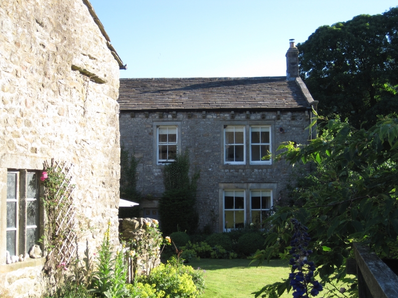
Carr Farmhouse
GV
II
House. Probably late C18, refenestrated late C19. Coursed rubble,
graduated stone slate roof. 2 storeys, 3 bays. Quoins. Central 6-panel door
in architrave with cornice. Flanking bays have paired 4-pane sashes in
plain surrounds with central mullions, single 4-pane sash over door.
Shaped gutter brackets. Shaped kneelers; gable copings; end stacks.
Listing NGR: SD9326571792
External links are from the relevant listing authority and, where applicable, Wikidata. Wikidata IDs may be related buildings as well as this specific building. If you want to add or update a link, you will need to do so by editing the Wikidata entry.


Other nearby listed buildings
