Latitude: 54.1466 / 54°8'47"N
Longitude: -2.0463 / 2°2'46"W
OS Eastings: 397073
OS Northings: 472307
OS Grid: SD970723
Mapcode National: GBR GN4H.SB
Mapcode Global: WHB6G.J1SH
Plus Code: 9C6V4XW3+JF
Entry Name: The King's Head
Listing Date: 4 May 1989
Grade: II
Source: Historic England
Source ID: 1316826
English Heritage Legacy ID: 324681
ID on this website: 101316826
Location: Kettlewell, North Yorkshire, BD23
County: North Yorkshire
District: Craven
Civil Parish: Kettlewell with Starbotton
Traditional County: Yorkshire
Lieutenancy Area (Ceremonial County): North Yorkshire
Tagged with: Architectural structure
SD 9672-9772 KETTLEWELL WITH STARBOTTON THE GREEN (north side) Kettlewell
21/95 The King's Head
GV II
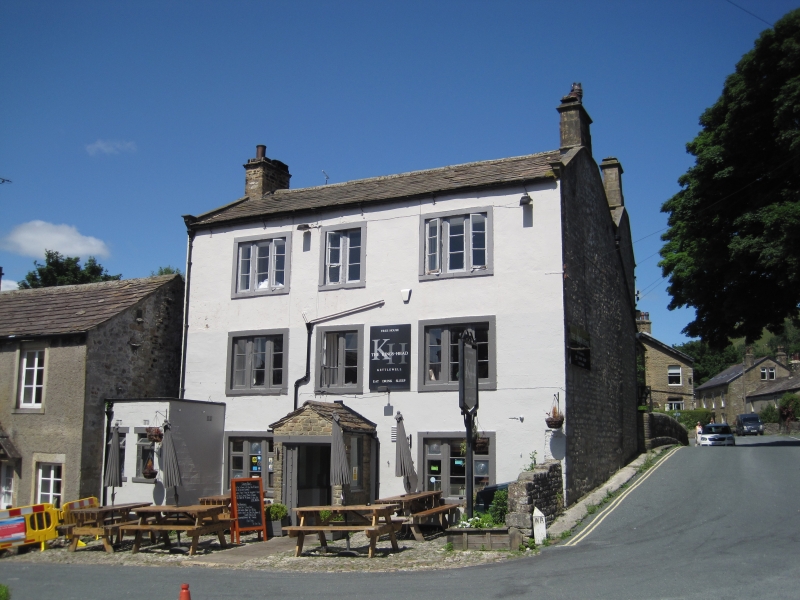
Public house. Mid C18. Rendered rubble, painted ashlar dressings, slate roof. 3 storeys, 3 x 2 bays with M roof. Central entrance obscured by C20 porch, not of special interest. Flat-faced mullion windows with raised surrounds throughout, of 3 lights to each floor bays 1 and 3 and of 2 lights above the central door. Shaped kneelers, gable copings, corniced end stacks. Right return: quoined rubble walling, the rear range an addition; a small blocked round window to first floor left. Interior: a fine ashlar fireplace with a 3-piece lintel inscribed in imitation of voussoirs against the left gable wall; the right front room has finely moulded cornice to the framed ceiling; staircase with knopped balusters to rear, centre. Ground floor partition walls removed.
Listing NGR: SD9707372307
External links are from the relevant listing authority and, where applicable, Wikidata. Wikidata IDs may be related buildings as well as this specific building. If you want to add or update a link, you will need to do so by editing the Wikidata entry.


Other nearby listed buildings