Latitude: 54.403 / 54°24'10"N
Longitude: -2.1663 / 2°9'58"W
OS Eastings: 389303
OS Northings: 500849
OS Grid: NY893008
Mapcode National: GBR FK9J.TF
Mapcode Global: WHB51.PLNG
Plus Code: 9C6VCR3M+5F
Entry Name: House Approximatley 75 Metres to South of Junction with Road to Keld
Listing Date: 5 September 1986
Grade: II
Source: Historic England
Source ID: 1317118
English Heritage Legacy ID: 322209
ID on this website: 101317118
Location: Keld, North Yorkshire, DL11
County: North Yorkshire
District: Richmondshire
Civil Parish: Muker
Traditional County: Yorkshire
Lieutenancy Area (Ceremonial County): North Yorkshire
Tagged with: House
NY 80 SE
7/124
MUKER
B6270
(east side), Keld
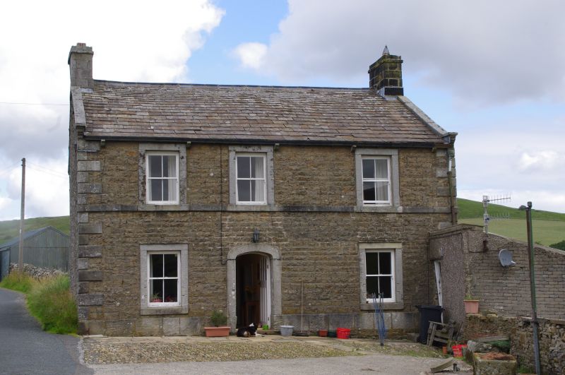
House approximately 75 metres to south of junction with road to Keld
II
Former inn, now house. Early C19. Coursed rubble with ashlar dressings,
stone slate roof. 2 storeys, 3 bays. Ashlar plinth, rusticated ashlar
quoins. Ashlar surrounds to openings. Central C20 panelled door in 4-
centred-arched surround. 4-pane sash windows, with dripmoulds on ground
floor. Sill band to first floor. Shaped kneelers, ashlar copings. Ashlar
end stacks. Rear elevation has windows in ashlar surrounds including round-
arched landing window with decorative glazing bars. Formerly the Cat Hole
Inn (named after the nearby Cat Hole waterfall) and the Butt House Inn.
Listing NGR: NY8930300849
External links are from the relevant listing authority and, where applicable, Wikidata. Wikidata IDs may be related buildings as well as this specific building. If you want to add or update a link, you will need to do so by editing the Wikidata entry.


Other nearby listed buildings