Latitude: 53.8409 / 53°50'27"N
Longitude: -0.4375 / 0°26'14"W
OS Eastings: 502910
OS Northings: 439431
OS Grid: TA029394
Mapcode National: GBR TSD0.2W
Mapcode Global: WHGF4.7QYB
Plus Code: 9C5XRHR7+92
Entry Name: 39, 41, Westwood Road
Listing Date: 30 June 1987
Grade: II
Source: Historic England
Source ID: 1317564
English Heritage Legacy ID: 167540
ID on this website: 101317564
Location: Beverley, East Riding of Yorkshire, HU17
County: East Riding of Yorkshire
Civil Parish: Beverley
Built-Up Area: Beverley
Traditional County: Yorkshire
Lieutenancy Area (Ceremonial County): East Riding of Yorkshire
Church of England Parish: Beverley St Mary
Church of England Diocese: York
Tagged with: Building
TA 0239
7/410
BEVERLEY
WESTWOOD ROAD
(south side)
Nos 39 and 41
GV
II
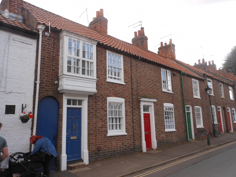
Early C19. 2 storeys in brick with dentil eaves cornice and pantile roof.
3 windows, glazing bars to that to No 41, that to No 39 over the door a
rectangular bay. Plain pilastered doorway with door of 6 fielded panels
that to No 39 part modern glass. Round-headed passage entry to left.
Listing NGR: TA0290339433
External links are from the relevant listing authority and, where applicable, Wikidata. Wikidata IDs may be related buildings as well as this specific building. If you want to add or update a link, you will need to do so by editing the Wikidata entry.


Other nearby listed buildings