Approximate Location Map
Large Map »
Latitude: 51.5214 / 51°31'17"N
Longitude: -0.5006 / 0°30'2"W
OS Eastings: 504122
OS Northings: 181346
OS Grid: TQ041813
Mapcode National: GBR 0B.Y6T
Mapcode Global: VHFTB.80PZ
Plus Code: 9C3XGFCX+HP
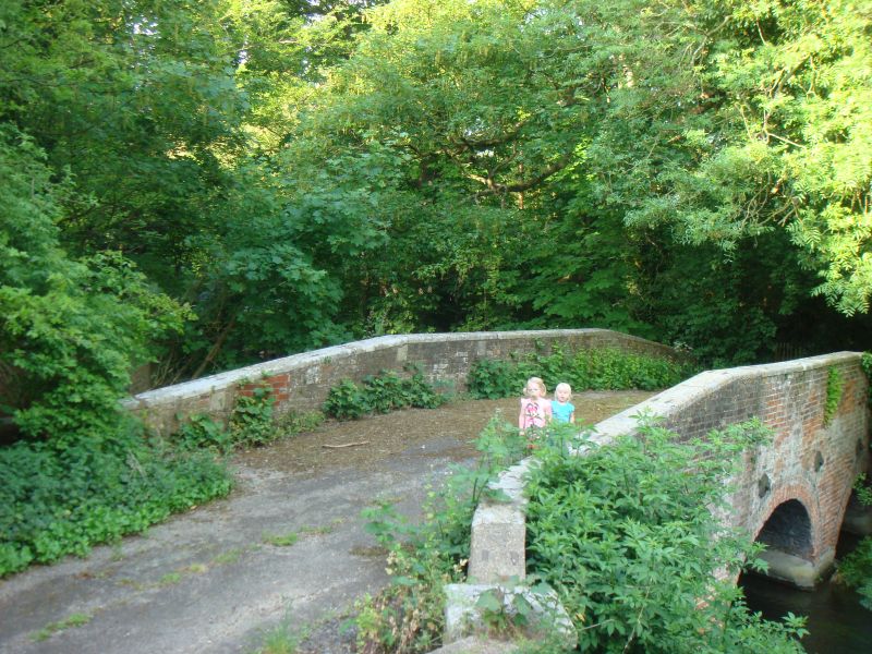
Entry Name: Bridge over Colne Brook
Listing Date: 23 September 1955
Grade: II
Source: Historic England
Source ID: 1317691
English Heritage Legacy ID: 44167
ID on this website: 101317691
Location: Iver, Buckinghamshire, SL0
County: Buckinghamshire
Civil Parish: Iver
Traditional County: Buckinghamshire
Lieutenancy Area (Ceremonial County): Buckinghamshire
Church of England Parish: Iver
Church of England Diocese: Oxford
Tagged with: Bridge
TQ 08 SW IVER IVER LANE
Iver
9/590
Bridge over Colne Brook
23.9.55
GV II
C18. Red brick. Three segmental arches. Stone coping to parapet.
Listing NGR: TQ0412281346
External links are from the relevant listing authority and, where applicable, Wikidata. Wikidata IDs may be related buildings as well as this specific building. If you want to add or update a link, you will need to do so by editing the Wikidata entry.


Other nearby listed buildings
