Latitude: 54.0094 / 54°0'34"N
Longitude: -2.8232 / 2°49'23"W
OS Eastings: 346147
OS Northings: 457361
OS Grid: SD461573
Mapcode National: GBR 8QQ2.LG
Mapcode Global: WH84D.LHT4
Plus Code: 9C6V255G+QP
Entry Name: Conduit Mouth Approx. 45 Metres North of Ashton Hall
Listing Date: 1 August 1952
Last Amended: 7 March 1985
Grade: II
Source: Historic England
Source ID: 1317723
English Heritage Legacy ID: 182261
ID on this website: 101317723
Location: Ashton park, Lancaster, Lancashire, LA2
County: Lancashire
District: Lancaster
Civil Parish: Thurnham
Traditional County: Lancashire
Lieutenancy Area (Ceremonial County): Lancashire
Church of England Parish: Glasson Christ Church
Church of England Diocese: Blackburn
Tagged with: Architectural structure
SD 45 NE THURNHAM
8/196 Conduit mouth approx. 45 metres north of Ashton Hall (Formerly listed with Ashton 1-8-1952 Hall as arch forming entrance of the beck to the fish pond under ASHTON with STODDAY)
GV II
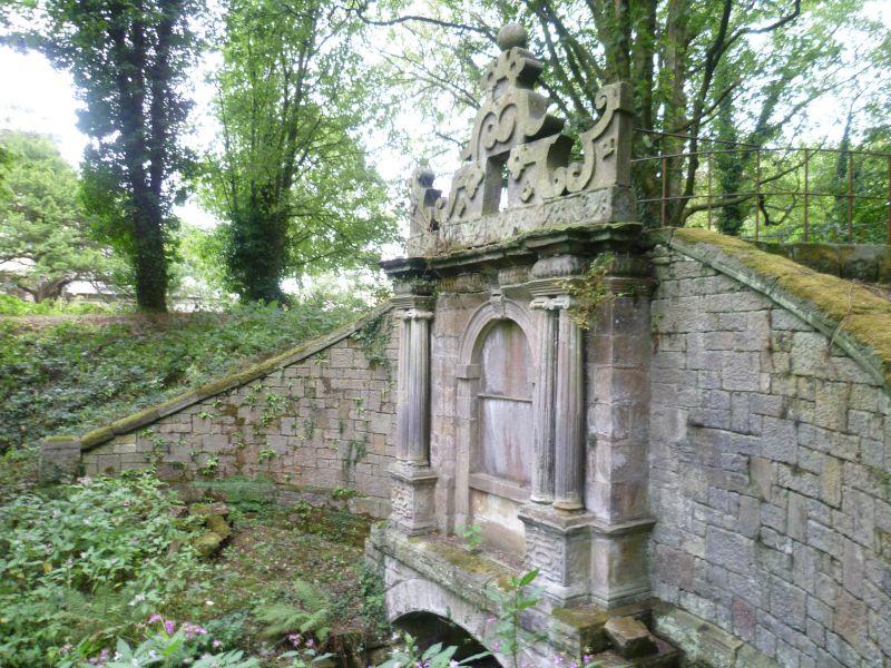
Conduit mouth, 1858, re-using some dressings of c.1600. Squared sandstone blocks. Comprises a stone-lined circular shaft with low coping and iron railings. The walls are carried over a stream by low bridges with segmental arches. On the east side the ground level is lower. Set above the bridge, facing east and flanked by retaining walls, is the upper part of the frontispiece removed from Ashton Hall (q.v.) during C19th rebuilding. It has 2 sets of paired Ionic columns on decorated pedestals supporting an entablature with decorated frieze. Above is a decorative gable and ball finials, now overgrown by ivy and difficult to distingush. Between the columns is an architrave with round head, carved keystone, and impost blocks. It new frames a plaque inscribed: 'These remains were removed from the Old Hall AD 1858'. A drawing by John Weld, in the Lancashire Record Office (DP/386), shows the house from the west in 1835, including the frontispiece.
Listing NGR: SD4614757361
External links are from the relevant listing authority and, where applicable, Wikidata. Wikidata IDs may be related buildings as well as this specific building. If you want to add or update a link, you will need to do so by editing the Wikidata entry.


Other nearby listed buildings