Approximate Location Map
Large Map »
Latitude: 51.5766 / 51°34'35"N
Longitude: -0.6026 / 0°36'9"W
OS Eastings: 496930
OS Northings: 187339
OS Grid: SU969873
Mapcode National: GBR F7F.4GV
Mapcode Global: VHFSW.HMSR
Plus Code: 9C3XH9GW+JX
Entry Name: Barn at Metcalfe Farmhouse
Listing Date: 26 April 1985
Grade: II
Source: Historic England
Source ID: 1317839
English Heritage Legacy ID: 44129
ID on this website: 101317839
Location: Hedgerley, Buckinghamshire, SL2
County: Buckinghamshire
Civil Parish: Hedgerley
Traditional County: Buckinghamshire
Lieutenancy Area (Ceremonial County): Buckinghamshire
Church of England Parish: Hedgerley
Church of England Diocese: Oxford
Tagged with: Barn
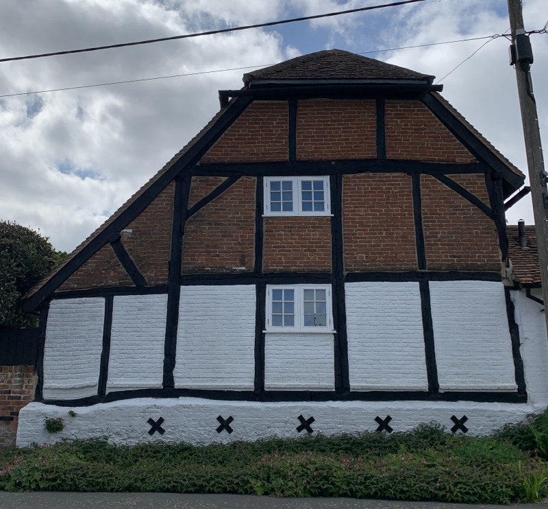
SU 98 NE HEDGERLEY VILLAGE LANE
4/533 Barn at Metcalfe
Farmhouse
-
- II
C17. Timber-framed with red brick nogging; old tile roof. Flint rubble and red
brick plinth. Three bays. Queen post truss. Modern addition on right hand.
Listing NGR: SU9693087339
External links are from the relevant listing authority and, where applicable, Wikidata. Wikidata IDs may be related buildings as well as this specific building. If you want to add or update a link, you will need to do so by editing the Wikidata entry.


Other nearby listed buildings
