Latitude: 54.4014 / 54°24'4"N
Longitude: -1.7409 / 1°44'27"W
OS Eastings: 416917
OS Northings: 500688
OS Grid: NZ169006
Mapcode National: GBR JK8J.WZ
Mapcode Global: WHC6D.7M7P
Plus Code: 9C6WC725+HJ
Entry Name: 14, the Green
Listing Date: 15 October 1973
Grade: II
Source: Historic England
Source ID: 1318411
English Heritage Legacy ID: 323018
ID on this website: 101318411
Location: Richmond, North Yorkshire, DL10
County: North Yorkshire
District: Richmondshire
Civil Parish: Richmond
Built-Up Area: Richmond
Traditional County: Yorkshire
Lieutenancy Area (Ceremonial County): North Yorkshire
Church of England Parish: Richmond with Holy Trinity with Hudswell
Church of England Diocese: Leeds
Tagged with: Building
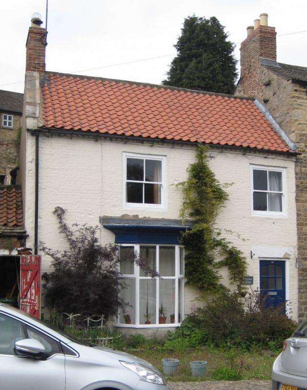
1. THE GREEN
1549 (North Side)
No 14
NZ 1600 NE 5/117
II GV
2.
C18, Two storeys in colourwashed brick. Pantile roof with chevron eaves
cornice. Two windows, hung sashes, C19 canted bay on ground floor. Modern
door under stone lintel.
Nos 2 to 14 (even) and Nos 18 to 26 (even) form a group
Listing NGR: NZ1691700688
External links are from the relevant listing authority and, where applicable, Wikidata. Wikidata IDs may be related buildings as well as this specific building. If you want to add or update a link, you will need to do so by editing the Wikidata entry.


Other nearby listed buildings