Latitude: 51.1049 / 51°6'17"N
Longitude: -2.3216 / 2°19'17"W
OS Eastings: 377582
OS Northings: 134001
OS Grid: ST775340
Mapcode National: GBR 0TV.MVR
Mapcode Global: VH97Z.QH1C
Plus Code: 9C3V4M3H+W9
Entry Name: Stourton Post Office and Stores
Listing Date: 9 September 1987
Grade: II
Source: Historic England
Source ID: 1318449
English Heritage Legacy ID: 321235
ID on this website: 101318449
Location: Stourton, Wiltshire, BA12
County: Wiltshire
Civil Parish: Stourton with Gasper
Traditional County: Wiltshire
Lieutenancy Area (Ceremonial County): Wiltshire
Church of England Parish: Upper Stour
Church of England Diocese: Salisbury
Tagged with: Post office
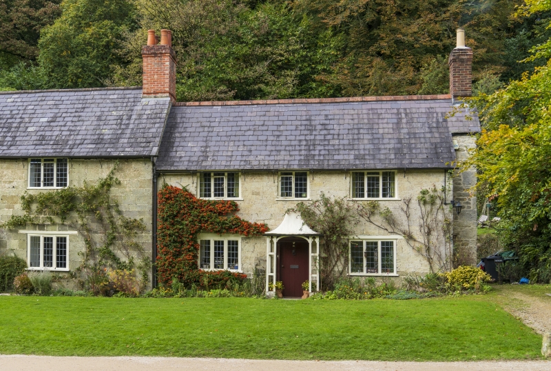
STOURTON WITH GASPER HIGH STREET ST 73 SE (north side) 6/129 Stourton Post Office and Stores GV II Cottage and shop at end of row. Late C18. Dressed limestone, Welsh slate roof, formerly thatched, large external stone and brick stack to right. Two-storey, 3-window. Central planked door in wooden tent porch, 3-light leaded casement either side. First floor has 3-light leaded casement either side of 2-light leaded casement with quadrant stay. Rear rubble stone wing with lower tiled hipped roof, 2-light and 3-light casements.
Listing NGR: ST7758534002
External links are from the relevant listing authority and, where applicable, Wikidata. Wikidata IDs may be related buildings as well as this specific building. If you want to add or update a link, you will need to do so by editing the Wikidata entry.


Other nearby listed buildings