Latitude: 54.2693 / 54°16'9"N
Longitude: -1.7849 / 1°47'5"W
OS Eastings: 414107
OS Northings: 485977
OS Grid: SE141859
Mapcode National: GBR HMZ2.CC
Mapcode Global: WHC6Y.KY8H
Plus Code: 9C6W7698+P2
Entry Name: Town End Farmhouse
Listing Date: 25 June 1985
Grade: II
Source: Historic England
Source ID: 1318522
English Heritage Legacy ID: 321642
ID on this website: 101318522
Location: East Witton, North Yorkshire, DL8
County: North Yorkshire
District: Richmondshire
Civil Parish: East Witton
Traditional County: Yorkshire
Lieutenancy Area (Ceremonial County): North Yorkshire
Tagged with: Farmhouse
SE 18 NW
10/20
EAST WITTON TOWN
EAST WITTON
(east end)
Town End Farmhouse
GV
II
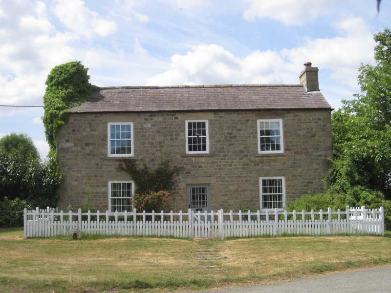
Farmhouse. Early/mid C19. Coursed rubble, Welsh slate roof. 2 storeys,
2 bays. Quoins. Openings have sandstone ashlar sills and lintels. Central
part-glazed C20 door. 16-pane sash window. Ashlar end stacks.
Listing NGR: SE1410785977
External links are from the relevant listing authority and, where applicable, Wikidata. Wikidata IDs may be related buildings as well as this specific building. If you want to add or update a link, you will need to do so by editing the Wikidata entry.


Other nearby listed buildings