Latitude: 51.0897 / 51°5'22"N
Longitude: -2.2708 / 2°16'14"W
OS Eastings: 381130
OS Northings: 132297
OS Grid: ST811322
Mapcode National: GBR 0V3.NQ3
Mapcode Global: FRA 6647.M4W
Plus Code: 9C3V3PQH+VM
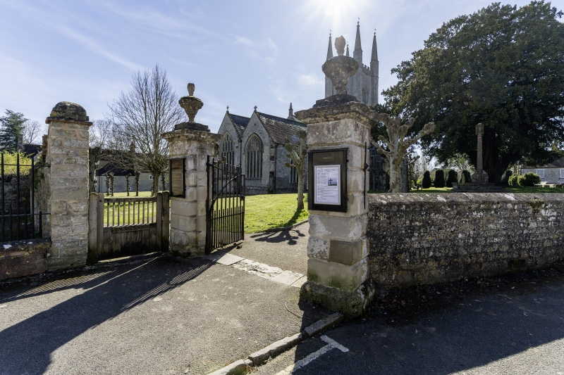
Entry Name: Gate Piers, Gates, and Boundary Wall to Churchyard St Michael
Listing Date: 6 January 1966
Grade: II
Source: Historic England
Source ID: 1318656
English Heritage Legacy ID: 320166
ID on this website: 101318656
Location: Mere, Wiltshire, BA12
County: Wiltshire
Civil Parish: Mere
Built-Up Area: Mere
Traditional County: Wiltshire
Lieutenancy Area (Ceremonial County): Wiltshire
Church of England Parish: Mere St Michael the Archangel
Church of England Diocese: Salisbury
Tagged with: Gatepost
ST 8032-8132 MERE CHURCH STREET (south and east sides) 6/41 Gate piers,gates, and 6.11.66 boundary wall to churchyard of St Michael
GV II
Three piers with pair of gates and railing, two wooden gates, and boundary walling. C18, but some walling possibly earlier. Limestone ashlar to piers, squared rubble elsewhere, cast-iron or wooden gates. Wall surrounds churchyard in varying height and form: to the east running north from the Charnel House (q.v.) to C18 piers is rubble c.2.5m high to a brick coping, then ashlar pier and wooden pedestrian gate returned towards the west to link with good pair of C18 ashlar rusticated piers set to offset chamfered plinths and with moulded cappings carrying decorative urns on square bases. Pair of iron gates with plain vertical bars and dog bars to dropped head and segmental strutting. To north of churchyard is squared and coursed stone to saddle-back coping cl.5 m above pavement, running to small wooden gate in north west corner, then section running south similar, but with chamfer-edge coping to flat top, height varying with fall in road, to wooden gate on 3 stone steps. Beyond this wall joins high wall to The Chantry (q.v.) at south west corner. south wall is partly high section to The Chantry, then lower part with saddle-back coping including iron gate with overthrow, opposite north doorway to The Chantry. Last section of enclosure is formed by the north wall to Dean(s orchard (q.v.) Modest, but important to the ensemble of the church and its surroundings.
Listing NGR: ST8112932295
External links are from the relevant listing authority and, where applicable, Wikidata. Wikidata IDs may be related buildings as well as this specific building. If you want to add or update a link, you will need to do so by editing the Wikidata entry.


Other nearby listed buildings