Approximate Location Map
Large Map »
Latitude: 54.3229 / 54°19'22"N
Longitude: -2.7451 / 2°44'42"W
OS Eastings: 351635
OS Northings: 492181
OS Grid: SD516921
Mapcode National: GBR 9L8G.H3
Mapcode Global: WH82W.TL0V
Plus Code: 9C6V87F3+5X
Entry Name: 9 and 11, Church Walk
Listing Date: 14 April 1969
Grade: II
Source: Historic England
Source ID: 1318977
English Heritage Legacy ID: 75361
ID on this website: 101318977
Location: Kirkbarrow, Westmorland and Furness, Cumbria, LA9
County: Cumbria
District: South Lakeland
Civil Parish: Kendal
Built-Up Area: Kendal
Traditional County: Westmorland
Lieutenancy Area (Ceremonial County): Cumbria
Church of England Parish: Kendal Holy Trinity
Church of England Diocese: Carlisle
Tagged with: Building
SD 5192 SE KENDAL CHURCH WALK
(North side)
11/19 Nos 9 & 11
14-4-69
G.V. II
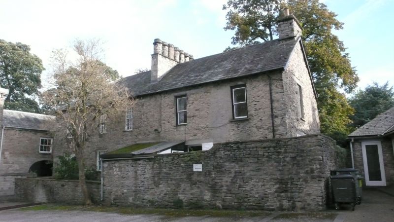
Old Grammar School, now 2 houses. No 11 is linked to Lakeland Life and Industry
Museum (in Abbot Hall Stable Block) by 1st floor walkway. School founded 1525
and closed 1888. Present site granted 1588; built by public subscription.
Subdivided and remodelled 1891 by J.F. Curwen. Coursed rubble with quoins.
Graduated slate roof, hipped to east end. Corniced stone chimney to west end
and large stone cross-ridge mid chimney with 7 cylindrical stacks. 2 storeys, 6
bays overall. South elevation: No 9 has full-height gabled wing added with
decorative barge-boards and crocketed finial; cylindrical stone chimney to
eaves. Door to no 9 in west return; plank door to no 11 under canopy carried on
pierced wooden brackets (left bracket dated 1592, and right 1891). C19 wooden
mullioned and transomed, diamond-leaded, windows inserted in older (larger)
openings, some under timber lintels. North elevation has some (C18?) sashes,
with wide glazing bars, inserted in earlier openings. Straight joint shows that
eastern bay was added. A massive stop-chamfered beam survives internally.
Forms part of churchyard group.
Listing NGR: SD5163992182
External links are from the relevant listing authority and, where applicable, Wikidata. Wikidata IDs may be related buildings as well as this specific building. If you want to add or update a link, you will need to do so by editing the Wikidata entry.


Other nearby listed buildings
