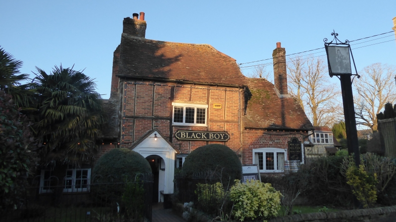
Latitude: 51.8855 / 51°53'7"N
Longitude: -0.8651 / 0°51'54"W
OS Eastings: 478209
OS Northings: 221378
OS Grid: SP782213
Mapcode National: GBR C0K.Q47
Mapcode Global: VHDTQ.YVJY
Plus Code: 9C3XV4PM+5X
Entry Name: The Black Boy
Listing Date: 25 October 1951
Last Amended: 19 January 1985
Grade: II
Source: Historic England
Source ID: 1319260
English Heritage Legacy ID: 42171
ID on this website: 101319260
Location: Oving, Buckinghamshire, HP22
County: Buckinghamshire
Civil Parish: Oving
Built-Up Area: Oving
Traditional County: Buckinghamshire
Lieutenancy Area (Ceremonial County): Buckinghamshire
Church of England Parish: Oving with Pitchcott
Church of England Diocese: Oxford
Tagged with: Pub Architectural structure
2/22 The Black Boy (formerly listed as The Black Boy Inn)
25.10.51 GV II
Public house. C17, altered and extended. Timber frame with brick infill, partly rebuilt in brick. Right gable has whitewashed rubble stone lower storey with jettied floor above. Half-hipped old tile roofs, brick chimney to left of tall centre bay. L-plan with 2-storey bay to centre of N. front, single storey C18 bay to left, and cross wing of one storey and an attic to right. Centre bay has 3-light leaded casements and C20 door to left. Gabled timber porch with semi-circular arch to front and moulded frame. Left bay has 3-light barred wooden casement. Right bay has 3-light leaded casement with segmental head. C19 brick extension to far end of cross wing, C20 extension in rear angle. Interior has stop- chamfered spine beams. RCHM II p.231 Mon. 7.
Listing NGR: SP7820921378
External links are from the relevant listing authority and, where applicable, Wikidata. Wikidata IDs may be related buildings as well as this specific building. If you want to add or update a link, you will need to do so by editing the Wikidata entry.


Other nearby listed buildings