Latitude: 52.1041 / 52°6'14"N
Longitude: -2.0012 / 2°0'4"W
OS Eastings: 400011
OS Northings: 245080
OS Grid: SP000450
Mapcode National: GBR 2JX.4VM
Mapcode Global: VHB0S.8CCW
Plus Code: 9C4V4X3X+JG
Entry Name: Churchyard Wall
Listing Date: 3 August 1972
Grade: II
Source: Historic England
Source ID: 1319721
English Heritage Legacy ID: 442624
ID on this website: 101319721
Location: Cropthorne, Wychavon, Worcestershire, WR10
County: Worcestershire
District: Wychavon
Civil Parish: Cropthorne
Built-Up Area: Cropthorne
Traditional County: Worcestershire
Lieutenancy Area (Ceremonial County): Worcestershire
Church of England Parish: Fladbury, Hill and Moor, Wyre Piddle, Cropthorne and Charlton
Church of England Diocese: Worcester
Tagged with: Churchyard wall
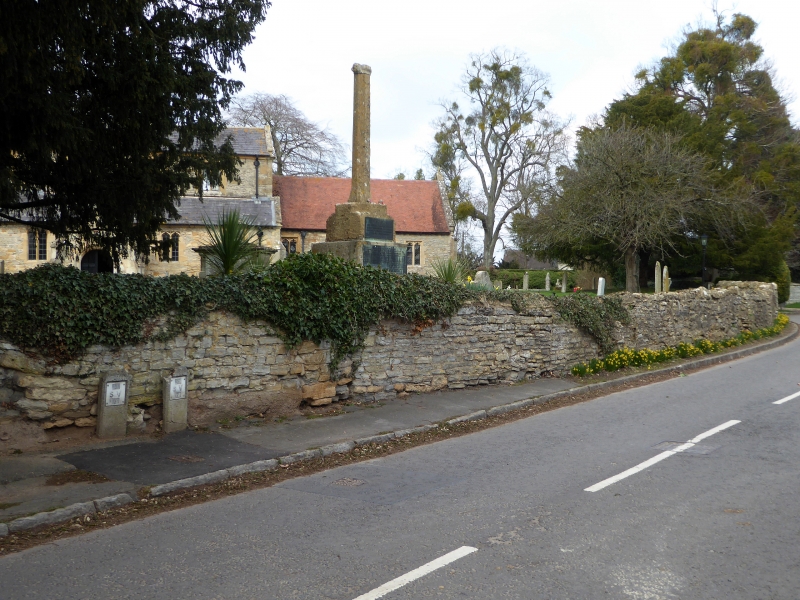
CROPTHORNE CROPTHORNE
1.
2301
Churchyard Wall
SP 04 Ml 11/251
II
2.
Low stone rubble wall with coping. Group v-alue.
Listing NGR: SP0000945081
External links are from the relevant listing authority and, where applicable, Wikidata. Wikidata IDs may be related buildings as well as this specific building. If you want to add or update a link, you will need to do so by editing the Wikidata entry.


Other nearby listed buildings