Latitude: 51.4621 / 51°27'43"N
Longitude: -2.5038 / 2°30'13"W
OS Eastings: 365094
OS Northings: 173800
OS Grid: ST650738
Mapcode National: GBR CXG.GQ
Mapcode Global: VH88P.KJ50
Plus Code: 9C3VFF6W+RF
Entry Name: Parish Church of the Holy Trinity and Churchyard Walls Fronting Street and on West, Running Southwards for Approximately 100 Yards
Listing Date: 6 June 1951
Grade: II*
Source: Historic England
Source ID: 1319749
English Heritage Legacy ID: 28729
ID on this website: 101319749
Location: Holy Trinity Church, Woodstock, South Gloucestershire, BS15
County: South Gloucestershire
Parish: Non Civil Parish
Built-Up Area: Bristol
Traditional County: Gloucestershire
Lieutenancy Area (Ceremonial County): Gloucestershire
Church of England Parish: Kingswood
Church of England Diocese: Bristol
Tagged with: Church building
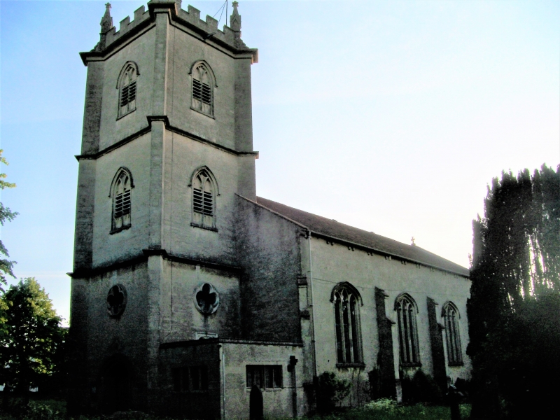
1. 5118 EX-KINGSWOOD UD HIGH STREET (south side) Kingswood Parish Church of the Holy Trinity and Churchyard walls fronting street and on west, running southwards for approximately 100 yds ST 6573 10/169 6.6.51 II* GV 2. 1821, a good example of Commissioners Gothic, altered by addition of 2 bay chancel and vestry in 1900 and roof of circa 1850. Ashlar on moulded plinth with Roman tile roof. Four bays, Tudor Gothick. Three-light windows in drips. Weathered buttresses, corner buttresses diagonal. Three stage embattled tower with corner finials and diagonal buttresses, Geometric windows one per face on each stage, lower stage has inscribed quatrefoils. Weathervane. Tudor arch west door, studded. Two bay chancel with slate roof, decorated-style windows and north and south chapels. Interior: original internal west door, Tudor Gothick panelling and studded stair turret door. West gallery with original side rails and panelling and with royal arms and dedication inscription on string. Chancel has 1897-1908 decorative scheme, part stencilled and part applied paintings. Two loose panels of stained glass, late C19 east window and small stained glass panels in north porch chapel. Church set back from High Street by graveyard. Rubble pennant wall about 3 ft high to street. The graveyard wall to west is original about 5-6 ft high pennant rubble with ironstone and oceas pennant buttresses.
Listing NGR: ST6509473800
External links are from the relevant listing authority and, where applicable, Wikidata. Wikidata IDs may be related buildings as well as this specific building. If you want to add or update a link, you will need to do so by editing the Wikidata entry.


Other nearby listed buildings