Latitude: 51.2801 / 51°16'48"N
Longitude: 1.0772 / 1°4'37"E
OS Eastings: 614699
OS Northings: 157941
OS Grid: TR146579
Mapcode National: GBR TY2.P4Y
Mapcode Global: VHLGM.M29Z
Plus Code: 9F3373JG+3V
Entry Name: Methodist Church
Listing Date: 3 December 1949
Grade: II
Source: Historic England
Source ID: 1319845
English Heritage Legacy ID: 442976
Also known as: St Peter's Methodist Church, Canterbury
ID on this website: 101319845
Location: Canterbury, Kent, CT1
County: Kent
District: Canterbury
Electoral Ward/Division: Westgate
Parish: Non Civil Parish
Built-Up Area: Canterbury
Traditional County: Kent
Lieutenancy Area (Ceremonial County): Kent
Tagged with: Protestant church building
1. 944 ST PETER'S STREET
Methodist Church TR 1457 NE 4/79 3.12.49.
II GV
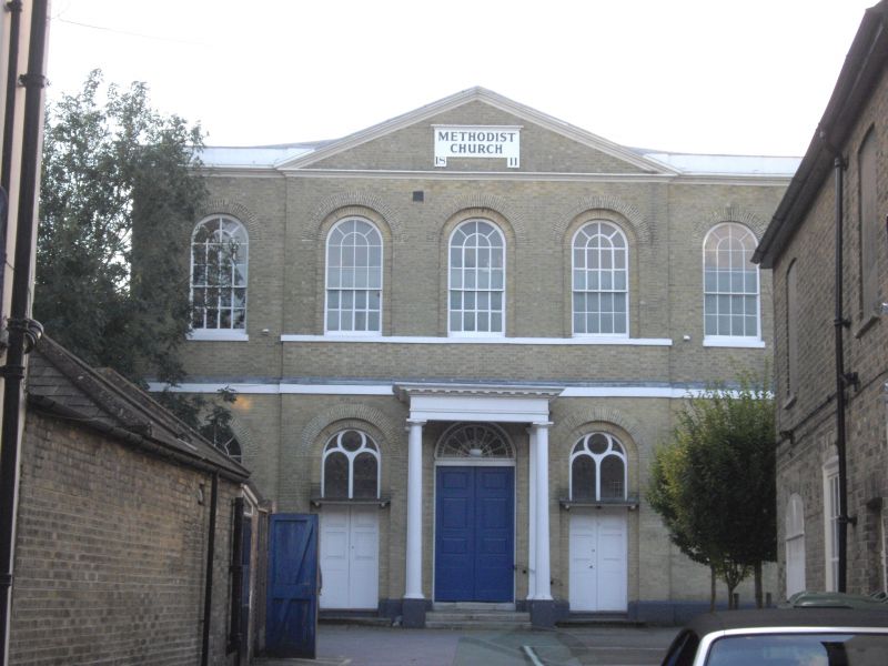
2. Dated 1811. 2 storeys buff brick with stone dressings. Central pediment. Stringcourse. 5 round-headed sashes, the 3 central ones recessed. The ground floor has a central Roman Doric porch with an 8 panelled door and semi-circular fanlight and 2 stone steps. The side elevation is of brick and has 2 rows of 5 round-headed sashes, some altered later in the C19. The interior retains its semi-circular gallery.
Forms a group with Forecourt to Methodist Church. Also forms a group with Nos 49 to 60 (consec).
Listing NGR: TR1470257932
External links are from the relevant listing authority and, where applicable, Wikidata. Wikidata IDs may be related buildings as well as this specific building. If you want to add or update a link, you will need to do so by editing the Wikidata entry.


Other nearby listed buildings